Lacroix-Saint-Ouen | |
|---|---|
) Coat of arms | |
Location of Lacroix-Saint-Ouen 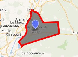 | |
) Lacroix-Saint-Ouen ) Lacroix-Saint-Ouen | |
| Coordinates: 49°21′16″N 2°47′10″E / 49.3544°N 2.7861°E | |
| Country | France |
| Region | Hauts-de-France |
| Department | Oise |
| Arrondissement | Compiègne |
| Canton | Compiègne-2 |
| Intercommunality | Région de Compiègne |
| Government | |
| • Mayor (2008–2014) | Jean Desessart |
| Area 1 | 20.83 km2 (8.04 sq mi) |
| Population (Jan. 2017)[1] | 4,708 |
| • Density | 230/km2 (590/sq mi) |
| Time zone | UTC+01:00 (CET) |
| • Summer (DST) | UTC+02:00 (CEST) |
| INSEE/Postal code | 60338 /60610 |
| Elevation | 30–54 m (98–177 ft) |
| 1 French Land Register data, which excludes lakes, ponds, glaciers > 1 km2 (0.386 sq mi or 247 acres) and river estuaries. | |
Lacroix-Saint-Ouen or La Croix Saint Ouen is a commune in the Oise department in northern France.
It lies 75 km north of Paris.
Population
| Year | Pop. | ±% |
|---|---|---|
| 1793 | 800 | — |
| 1800 | 934 | +16.8% |
| 1806 | 1,012 | +8.4% |
| 1821 | 1,084 | +7.1% |
| 1831 | 1,143 | +5.4% |
| 1836 | 1,152 | +0.8% |
| 1841 | 1,159 | +0.6% |
| 1846 | 1,250 | +7.9% |
| 1851 | 1,216 | −2.7% |
| 1856 | 1,179 | −3.0% |
| 1861 | 1,179 | +0.0% |
| 1866 | 1,309 | +11.0% |
| 1872 | 1,375 | +5.0% |
| 1876 | 1,416 | +3.0% |
| 1881 | 1,452 | +2.5% |
| 1886 | 1,471 | +1.3% |
| 1891 | 1,526 | +3.7% |
| 1896 | 1,576 | +3.3% |
| 1901 | 1,679 | +6.5% |
| 1906 | 1,728 | +2.9% |
| 1911 | 1,746 | +1.0% |
| 1921 | 1,623 | −7.0% |
| 1926 | 1,673 | +3.1% |
| 1931 | 2,008 | +20.0% |
| 1936 | 2,012 | +0.2% |
| 1946 | 1,931 | −4.0% |
| 1954 | 2,036 | +5.4% |
| 1962 | 2,330 | +14.4% |
| 1968 | 2,558 | +9.8% |
| 1975 | 3,203 | +25.2% |
| 1982 | 3,475 | +8.5% |
| 1990 | 3,754 | +8.0% |
| 1999 | 4,233 | +12.8% |
| 2012 | 4,368 | +3.2% |
The inhabitants are called Croisés-Saintodoniens.
See also
References
- ^ "Populations légales 2017". INSEE. Retrieved 6 January 2020.
External links