La Bresse | |
|---|---|
) The centre of La Bresse, seen from the Roche du Daval | |
) Coat of arms | |
Location of La Bresse 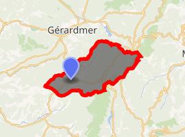 | |
) La Bresse ) La Bresse | |
| Coordinates: 48°00′24″N 6°52′36″E / 48.0067°N 6.8767°E | |
| Country | France |
| Region | Grand Est |
| Department | Vosges |
| Arrondissement | Saint-Dié-des-Vosges |
| Canton | La Bresse |
| Intercommunality | CC Hautes Vosges |
| Government | |
| • Mayor (2008–2014) | Guy Vaxelaire |
| Area 1 | 57.94 km2 (22.37 sq mi) |
| Population (Jan. 2017)[1] | 4,154 |
| • Density | 72/km2 (190/sq mi) |
| Time zone | UTC+01:00 (CET) |
| • Summer (DST) | UTC+02:00 (CEST) |
| INSEE/Postal code | 88075 /88250 |
| Elevation | 580–1,366 m (1,903–4,482 ft) (avg. 635 m or 2,083 ft) |
| 1 French Land Register data, which excludes lakes, ponds, glaciers > 1 km2 (0.386 sq mi or 247 acres) and river estuaries. | |
La Bresse is a commune in the Vosges department in Grand Est in northeastern France. The area is known for its ski resorts and outdoor activities. [2]
La Bresse is located about 45km west of Colmar and 55km north west of Mulhouse in the valley of the Moselotte river within the Vosges regional park.
See also
- Communes of the Vosges department
- Hohneck
- Kastelberg
References
 La Bresse travel guide from Wikivoyage
- ^ "Populations légales 2017". INSEE. Retrieved 6 January 2020.
- ^ "La Bresse-Hohneck Une station Labellemontagne – Fournisseur officiel de sensations". La Bresse - La Belle Montagne. Retrieved 3 September 2020.
External links
- (in French) Official website