Kyoto Municipal Subway Logo | |||
| Overview | |||
|---|---|---|---|
| Native name | 京都市営地下鉄 Kyōto-shiei chikatetsu | ||
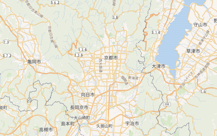
| Locale | Kyoto, Japan | ||
| Transit type | Rapid Transit | ||
| Number of lines | 2 | ||
| Number of stations | 31 | ||
| Daily ridership | 397,000 (2018)[1] | ||
| Website | www2 | ||
| Operation | |||
| Began operation | 1981 | ||
| Operator(s) | Kyoto Municipal Transportation Bureau | ||
| Technical | |||
| System length | 31.2 km (19.4 mi) | ||
| Track gauge | 1,435 mm (4 ft 8 1&fras1;2 in) standard gauge | ||
| Electrification | 1.5 kV DC overhead catenary | ||
| |||
)
The Kyoto Municipal Subway (京都市営地下鉄, Kyōto-shiei chikatetsu), also known as Kyoto City Subway, is the rapid transit network in the city of Kyoto, Japan. It is operated by Kyoto Municipal Transportation Bureau. It has two lines.
Lines
The Kyoto Municipal Subway is made up of two lines: the 13.7-kilometer (8.5 mi) long, 15-station Karasuma Line, and the 17.5-kilometer (10.9 mi) long, 17-station Tōzai Line, which together share one interchange station (Karasuma Oike Station):[2]
| Color & Icon | Mark | Name | First section opened | Last ex- tension | Length | Stations | ||
|---|---|---|---|---|---|---|---|---|
| green | K | - | Karasuma Line | 1981 | 1997 | 13.7 km (8.5 mi) | 15 | |
| - | Via trackage rights | Kintetsu Kyōto Line | 1988[Note 1] | 2000 | 31.0 km (19.3 mi) | 22[Note 2] | ||
| Kintetsu Nara Line | 2000[Note 3] | - | 4.4 km (2.7 mi) | 3[Note 4] | ||||
| vermilion | T | - | Tōzai Line | 1997[Note 5] | 2004 | 8.7 km (5.4 mi) | 8 | |
| Via trackage rights | 1997[Note 6] | - | 3.4 km (2.1 mi) | 3[Note 7] | ||||
| - | 1997[Note 8] | - | 3.0 km (1.9 mi) | 4[Note 9] | ||||
| - | 2008[Note 10] | - | 2.4 km (1.5 mi) | 2[Note 11] | ||||
| Total | 31.2 km (19.4 mi) | 31 | ||||||
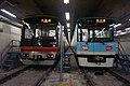
Rolling stock
Karasuma Line
- Kyoto Municipal Subway 10 series
- Kintetsu 3200 series
- Kintetsu 3220 series

Kyoto Municipal Subway 10 series

Kintetsu 3200 series

Kintetsu 3220 series
)
)
)
Tozai Line
- Kyoto Municipal Subway 50 series
- Keihan 800 series
Kyoto Municipal Subway 50 series and Keihan 800 series
)
Network Map
See also
- Transport in Keihanshin
- List of metro systems
Notes
- ^ Between Takeda Station and Yamato-Saidaiji Station.
- ^ Including Takeda Station.
- ^ Between Yamato-Saidaiji Station and Kintetsu Nara Station.
- ^ Including Yamato-Saidaiji Station.
- ^ Between Rokujizō Station and Misasagi Station.
- ^ Between Misasagi Station and Sanjō Keihan Station; owned by Kyoto High-Speed Rail.
- ^ Including Keage Station, Higashiyama Station and Sanjō Keihan Station, but not including Misasagi Station.
- ^ Between Sanjō Keihan Station and Nijō Station.
- ^ Including Kyoto Shiyakusho-mae Station, Nijōjō-mae Station and Nijō Station, and the Karasuma Oike interchange station (previously counted with the Karasuma Line), but not including Sanjō Keihan Station.
- ^ Between Nijō Station and Uzumasa Tenjingawa Station.
- ^ Including Nishiōji Oike Station and Uzumasa Tenjingawa Station.
References
- ^ "市バス・地下鉄のお客様数について" (in Japanese). Retrieved June 25, 2019.
- ^ "Kyoto Municipal Subway". Japan Subway Association.
External links
![]() Media related to Kyoto Subway at Wikimedia Commons
Media related to Kyoto Subway at Wikimedia Commons