Kfar Sirkin כְּפַר סִירְקִין | |
|---|---|
) | |
) Kfar Sirkin | |
| Coordinates: 32°4′36.26″N 34°55′25.48″E / 32.0767389°N 34.9237444°E | |
| Country | Israel |
| District | Central |
| Council | Southern Sharon |
| Founded | 1933 |
| Population (2019)[1] | 1,502 |
| Website | http://www.kfarsirkin.org.il/ |
Kfar Sirkin or Kefar Syrkin (Hebrew: כְּפַר סִירְקִין) is a moshav in central Israel. Located south-east of Petah Tikva, it falls under the jurisdiction of Drom HaSharon Regional Council. In 2019 it had a population of 1,502.[1]
History
Kfar Sirkin was founded in 1933 and was named for the Zionist leader Nachman Syrkin. It served as a Jewish stronghold in the 1936–1939 Arab revolt in Palestine, with the Haganah using the village to fight off attacking Arab forces and to store weapons which were illegal under the British Mandate rule of the time.
Today, the village is agricultural. An Israel Defense Forces military base is located to the north-west of the village.
Gallery
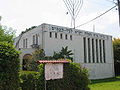
Local synagogue
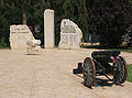
Memorial to residents who fell in the line of duty
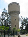
Water tower
.jpg)
Kfar Sirkin base 16 June 1948
)
)
)
.jpg'))
References
- ^ a b "Population in the Localities 2019" (XLS). Israel Central Bureau of Statistics. Retrieved 16 August 2020.