| Jakupica Jakupicë | |
|---|---|
| Solunska Glava | |
) Jakupica mountain with its peak Solunska Glava in the center | |
| Highest point | |
| Elevation | 2,540 m (8,330 ft) [1] |
| Prominence | 1,666 m (5,466 ft) |
| Listing | Ultra |
| Coordinates | 41°42′15″N 21°24′19″E / 41.70417°N 21.40528°E |
| Geography | |
) Solunska Glava North Macedonia | |
| Parent range | Jakupica |
| Climbing | |
| Easiest route | Easy hike, but the very summit (approx. last 30 meters) is closed by military. |
Jakupica (Macedonian: , Albanian: Jakupicë) or Mokra[2] (Macedonian: Мокра, Albanian: Mokër) is a mountain range in the central part of North Macedonia. Its highest peak is Solunska Glava 2,540 m (8,333 ft). Other significant peaks are: Karadžica (Albanian: Karaxhicë, 2,473 m), Popovo Brdo (2,380 m), Ostar Breg (2,365 m), Ubava (Albanian: Ubavë, 2,353 m), Ostar Vrv (2,275 m), and Dautica (2,178 m).
The relief is criss-crossed by numerous clear and fast mountain rivers. Large areas are covered with beech, oak, and conifer forests. There are also obvious traces of the primeval glaciation from the diluvial period. A number of institutions have been recommending the promotion of this area (and the one of the Šar Mountains) into a national park.
This mountain range can be easily approached from the capital Skopje, or from the town of Veles and many villages in the area.
On clear days, from the peak Solunska Glava, one could even see the city of Thessaloniki, in Greece.
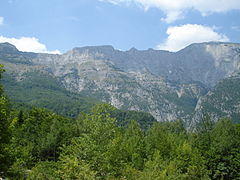
Landscape of Jakupica, Solunska Glava at far right
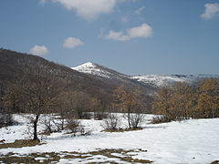
Dautica mountain
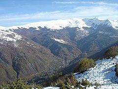
Karadžica mountain and Patiška Reka village
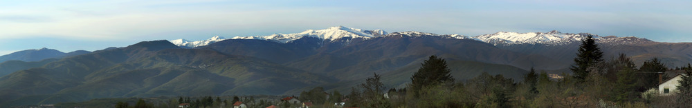
Jakupica mountain range, as seen from Dolno Sonje, North Macedonia, with the highest peak Solunska Glava in the middle
)
)
)
)
See also
- List of mountains in North Macedonia
- List of non-Alpine European Ultras
References
- ^ http://www.ii.uib.no/~petter/mountains/europf.html#glava
- ^ Bulletin Scientifique: Sciences humaines. Le Conseil. 1969. p. 215. Retrieved 6 April 2013.
massif of Mokra Planina (Jakupica)
External links
 Media related to Jakupica at Wikimedia Commons
- Mount Jakupica on Youtube