| ||||
|---|---|---|---|---|
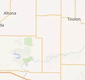 IL 180 highlighted in red | ||||
| Route information | ||||
| Maintained by IDOT | ||||
| Length | 15.43 mi[2] (24.83 km) | |||
| Existed | 1924[1]–present | |||
| Major junctions | ||||
| South end | ||||
| North end | ||||
| Location | ||||
| Counties | Knox | |||
| Highway system | ||||
Illinois State Highway System
| ||||
)
Illinois Route 180 (IL 180) is a 15.43-mile-long (24.83 km) north–south state road located in Knox County in the central portion of the U.S. state of Illinois. It runs from U.S. Route 150 south of Williamsfield north to Illinois Route 17 south of Galva.[2]
Route description
Route 180 begins at a junction with US 150 south of Williamsfield. From here, the route heads north into Williamsfield. After passing through Williamsfield, the highway continues north through a rural area. The route briefly turns west near Snakeden Hollow State Fish and Wildlife Area before curving north and meeting Illinois Route 167 at its eastern terminus east of Victoria. Route 180 continues north past this junction and passes the community of Centerville. Past Centerville, the highway continues through farmland until its northern terminus at Route 17 south of Galva.[3] Illinois Route 180 is a two-lane road for its entire length.[4]
History
SBI Route 180 was established in 1924. Its routing has not changed since its establishment.[1]
Major intersections
The entire route is in Knox County.
| Location | mi[3] | km | Destinations | Notes | |
|---|---|---|---|---|---|
| Truro Township | 0.0 | 0.0 | Southern terminus of IL 180 | ||
| Victoria Township | 10.4 | 16.7 | Eastern terminus of IL 167 | ||
| Lynn Township | 15.4 | 24.8 | Northern terminus of IL 180 | ||
| 1.000 mi = 1.609 km; 1.000 km = 0.621 mi | |||||
References
- ^ a b Carlson, Rich (2005-04-15). "Illinois Highways Page: Routes 161 thru 180". Retrieved 2006-12-11.
- ^ a b Illinois Technology Transfer Center (2006). "T2 GIS Data". Retrieved 2007-11-08.
- ^ a b Google (February 28, 2013). "Overview Map of Illinois Route 180" (Map). Google Maps. Google. Retrieved February 28, 2013.
- ^ General Highway Map: Knox County, Illinois (PDF) (Map). Illinois Department of Transportation. 2010. Archived from the original (PDF) on March 6, 2012. Retrieved February 28, 2013.