Hirvensalmi | |
|---|---|
Municipality | |
| Hirvensalmen kunta Hirvensalmi kommun | |
 Hirvensalmi Church | |
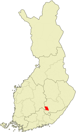
 Location of Hirvensalmi in Finland | |
| Coordinates: 61°38.5′N 026°47′E / 61.6417°N 26.783°E | |
| Country | |
| Region | Southern Savonia |
| Sub-region | Mikkeli sub-region |
| Charter | 1656 |
| Government | |
| • Municipal manager | Seppo Ruhanen |
| Area (2018-01-01)[1] | |
| • Total | 746.59 km2 (288.26 sq mi) |
| • Land | 465.38 km2 (179.68 sq mi) |
| • Water | 281.2 km2 (108.6 sq mi) |
| Area rank | 186th largest in Finland |
| Population (2020-12-31)[2] | |
| • Total | 2,155 |
| • Rank | 254th largest in Finland |
| • Density | 4.63/km2 (12.0/sq mi) |
| Population by native language | |
| • Finnish | 98.8% (official) |
| • Swedish | 0.3% |
| • Others | 0.9% |
| Population by age | |
| • 0 to 14 | 14.2% |
| • 15 to 64 | 57.9% |
| • 65 or older | 27.9% |
| Time zone | UTC+02:00 (EET) |
| • Summer (DST) | UTC+03:00 (EEST) |
| Municipal tax rate[5] | 19.5% |
| Website | www.hirvensalmi.fi |
Hirvensalmi is a municipality of Finland.
It is located in the Southern Savonia region. The municipality has a population of 2,155 (31 December 2020)[6] and covers an area of 746.59 square kilometres (288.26 sq mi) of which 281.2 km2 (108.6 sq mi) is water.[1] The population density is 4.63 inhabitants per square kilometre (12.0/sq mi).
Neighbour municipalities: Joutsa, Kangasniemi, Mikkeli, Mäntyharju and Pertunmaa.
Hirvensalmi is often said to be an island municipality. Most people live on the mainland, but living on an island is not unheard of. Most islands, though, are only inhabited during the summer holidays, when holidaymakers come mainly from Southern Finland and double the population of Hirvensalmi. In the north lake Puula marks the border of Hirvensalmi and Kangasniemi, and in the west lake Suontee separates it from Joutsa.
The municipality is unilingual Finnish.
Some villages
Hirvenlahti, Hirvensalmi, Hämeenmäki, Kekkola, Kilkki, Kissakoski, Kotkatvesi, Kuitula, Lahnaniemi, Lelkola, Malvaniemi, Monikkala, Noitti, Pääskynsaari, Suonsalmi, Syväsmäki, Vahvamäki, Vahvaselkä, and Väisälä.
References
- ^ a b "Area of Finnish Municipalities 1.1.2018" (PDF). National Land Survey of Finland. Retrieved 30 January 2018.
- ^ "Suomen virallinen tilasto (SVT): Väestön ennakkotilasto [verkkojulkaisu]. Joulukuu 2020" (in Finnish). Statistics Finland. Retrieved 11 February 2021.
- ^ "Population according to language and the number of foreigners and land area km2 by area as of 31 December 2008". Statistics Finland's PX-Web databases. Statistics Finland. Retrieved 29 March 2009.
- ^ "Population according to age and gender by area as of 31 December 2008". Statistics Finland's PX-Web databases. Statistics Finland. Retrieved 28 April 2009.
- ^ "List of municipal and parish tax rates in 2011". Tax Administration of Finland. 29 November 2010. Retrieved 13 March 2011.
- ^ "VÄESTÖTIETOJÄRJESTELMÄ REKISTERITILANNE 31.1.2012" (in Finnish and Swedish). Population Register Center of Finland. Archived from the original on 3 October 2013. Retrieved 11 February 2014.
External links
![]() Media related to Hirvensalmi at Wikimedia Commons
Media related to Hirvensalmi at Wikimedia Commons
- Municipality of Hirvensalmi – Official site (in Finnish and English)
