Heiligenthal | |
|---|---|
Ortsteil of Südergellersen | |
.jpg')) Coat of arms | |
Location of Heiligenthal 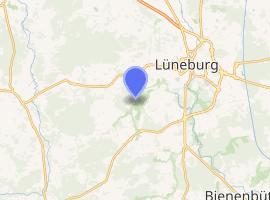 | |
) Heiligenthal ) Heiligenthal | |
| Coordinates: 53°22′15″N 10°33′46″E / 53.37083°N 10.56278°E | |
| Country | Germany |
| State | Lower Saxony |
| District | Lüneburg |
| Municipal assoc. | Gellersen |
| Municipality | Südergellersen |
| Founded | unknown |
| Government | |
| • Mayor | Annette Kammeier[1] (CDU) |
| • Governing parties | CDU (6 Seats) / SPD (2 Seats) / Bündnis 90/Die Grünen (2 Seats) FDP (1 Seat) |
| Elevation | 44 m (144 ft) |
| Population (2017-04-03) | |
| • Total | 381 |
| Time zone | UTC+01:00 (CET) |
| • Summer (DST) | UTC+02:00 (CEST) |
| Postal codes | 21394 |
| Dialling codes | 04135 |
| Vehicle registration | LG |
Heiligenthal is a village in the municipality of Südergellersen in the district of Lüneburg, Lower Saxony, Germany. It is located in the south-west of Lüneburg, the closest larger city which offers important infrastructure such as a railway station, highway access and a sport airfield. Single-family homes define the scape of the village in modern times. Until today several farmsteads are located in the south of the village and a chapel reminds of the former monastery Sancta Vallis, on which ground it was built. An important landmark, located opposite the chapel, is a war memorial reminding of soldiers who fought in World War I.
Etymology
A list of goods by the bishop of Verden dating back to 1252 uses the name Sybergeborstelde (later: Sibelincheborstolde or Sibelingheborstolde) for the village of Heiligenthal.[2] Later documents record the village under the name of Hilgendale, Hilligendahle or Alt-Heiligenthal (Antiqua Hilgendal),[3] following the relocation of the Premonstratensian monastery Sancta Vallis (Holy Valley) [4] from Kirchgellersen to Heiligenthal in the early 14th century.[5]
History
Several tumulus are still visible today within the woods around the village. Studies show that the oldest date back to the Stone Age and archaeological excavations, that started in the 1990s, revealed tumulus from the Bronze Age that include several funerary gifts.[6]
On 1 March 1974, Heiligenthal was integrated into the municipality of Südergellersen.[7]
Population Development
| Year | 1925 | 1933 | 1939 |
|---|---|---|---|
| Population[8] | 133 | 160 | 146 |
Religion
The village was part of the parish of Kirchgellersen in 1848.[9] Until today it has its own Chappell that is used for festive ceremonies and special occasions like weddings or funeral service. The brick Chappell was first build in 1568 as shown by inscription panels that are embedded in the walls and remind of the founder, Anna von Möller, wife of the first laird of Heiligenthal. Renovation were carried out in 1837, 1922 and 1975. The baptismal was created in 1665 by an unknown artist.[10]
Transportation
Heiligenthal is connected to all surrounding villages by a network of city-level asphalt roads. Only minor settlements, like Böhmsholz, are connected to Heiligenthal by sand roads.
Individual Transport
Private transport is essential in Heiligenthal with most citizen owning a private car. With three exceptions, all roads within the village are connected by the main road, the Hauptstraße which forms a central axis. In the North-East it connects Heiligenthal to Rettmer and Lüneburg while it continuous in the West towards Kirchgellersen. South of the main road lies the Südergellerser Weg, running towards Südergellersen as well as In de Tüünen and Am Sportplatz, both connecting the Südergellerser Weg with the Hauptstraße. North of it lies the Voigtskamp, the Schnellenberger Weg, the Gutshof as well as the Böhmsholzer Weg. Only the latter continuous as an asphalt road towards Kirchgellersen and serves the Lerchenweg, Heideweg and Waldweg.
Besides, all main roads connecting Heiligenthal to surrounding villages are equipped with bike lanes next to the street allowing for an environmentally friendly commute.
Public Transport
Despite Heiligenthals heavy reliance on private modes of transport, it is served by the local transportation network of the KVG and HVV, with infrequent bus connections to Lüneburg and surrounding villages.[11] Those are mostly used by schoolchildren, commuters and elderly and are in part operated at an on demand basis. The buses of the on-demand pilot project are running, like the regular service, along a fixed route and at a fixed timetable. However, only if requested by passengers in advance.[12] The project aims to organically improve the affordable public transport and to uphold a flexibility that guarantees adjustments to customers needs. For the customer, the usual HVV tariff applies. As of 2021, the on-demand line 5251 serves the villages of Kirchgellersen, Oedeme, Südergellersen, Reppenstedt, Dachtmissen, Vögelsen and Bardowick.[13]
References
- ^ https://www.gellersen.de/home/ihre-samtgemeinde/samtgemeinde-gellersen-2/mitgliedsgemeinden/gemeinde-suedergellersen.aspx (in German)
- ^ Brosious, Dieter: Urkundenbuch des Klosters Scharnebeck, Hildesheim 1979 (p. 37f.)
- ^ Lutz Tetau, Dietmar Gehrke 2017: Südergellersen: graue Vorzeit und dunkles Mittelalter: 750 Jahre Südergellersen
- ^ https://www.lustauflueneburg.de/kloster-heiligenthal/#gsc.tab=0
- ^ Helms, Herrmann 1926: Das Prämonstratenserkloster Heiligenthal: Gründung, Verfassung, Wirtschaft und Verfall (p.310) & Mindermann, Arend 2004: Urkundenbuch der Bischöfe und des Domkapitels von Verden, Band 2 1300-1380 (p. 102ff.)
- ^ Lutz Tetau, Dietmar Gehrke 2017: Südergellersen: graue Vorzeit und dunkles Mittelalter: 750 Jahre Südergellersen (p. 15ff.)
- ^ Friedrich W. Harseim, C. Schlüter 1848, Statistisches Handbuch für das Königreich Hannover, Schlüter, 232
- ^ Michael Rademacher: Deutsche Verwaltungsgeschichte von der Reichseinigung 1871 bis zur Wiedervereinigung 1990. Stadt und Landkreis Lüneburg. (Online-Material zur Dissertation, Osnabrück 2006).
- ^ http://www.suedergellersen.de/index.php?article_id=11 (in German)
- ^ https://www.gellersen.de/home/kultur-freizeit-tourismus/tourismus/sehenswuerdigkeiten/gutskapelle-heiligenthal.aspx
- ^ https://www.kvg-bus.de/fileadmin/user/pdf/fahrplaene/5201.pdf
- ^ https://www.landkreis-lueneburg.de/Home-Landkreis-Lueneburg/Verkehr-Sicherheit-und-Ordnung/Verkehr-Landkreis/rufbus.aspx
- ^ https://www.landkreis-lueneburg.de/Portaldata/42/Resources/verkehr,_sicherheit_und_ordnung/verkehr/rufmobil/RufMobil_Gellersen_190619_1.2.pdf