Hanak | |
|---|---|
 | |
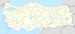
| Coordinates: 41°14′10″N 42°50′50″E / 41.23611°N 42.84722°E | |
| Country | Turkey |
| Province | Ardahan |
| Government | |
| • Mayor | Ayhan Büyükkaya (CHP) |
| • Kaymakam | Süleyman Ovalı |
| Area | |
| • District | 546.78 km2 (211.11 sq mi) |
| Population (2012)[2] | |
| • Urban | 3,943 |
| • District | 9,891 |
| • District density | 18/km2 (47/sq mi) |
| Post code | 75900 |
| Website | www.hanak.bel.tr |
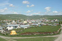
Hanak is a district of Ardahan Province of Turkey, on the road from Ardahan to Posof.
Villages
- Altınemek
- Aşağıaydere
- Baştoklu
- Binbaşak
- Börk
- Çatköy
- Çavdarlı
- Çayağzı
- Çiçeklidağ
- Çimliçayır
- Güneşgören
- İncedere
- Karakale
- Koyunpınarı
- Sazlıçayır
- Serinkuyu
- Sevimli
- Sulakçayır
- Yamaçyolu
- Yamçılı
- Yukarıaydere
- Yünbüken
References
- ^ "Area of regions (including lakes), km²". Regional Statistics Database. Turkish Statistical Institute. 2002. Retrieved 2013-03-05.
- ^ "Population of province/district centers and towns/villages by districts - 2012". Address Based Population Registration System (ABPRS) Database. Turkish Statistical Institute. Retrieved 2013-02-27.
See also
- Hanák
- Hanakia
