Gramat | |
|---|---|
) Market square | |
.svg.gif')) Coat of arms | |
Location of Gramat 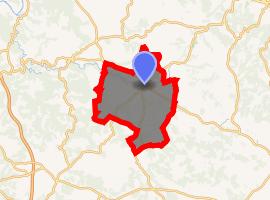 | |
) Gramat ) Gramat | |
| Coordinates: 44°46′47″N 1°43′33″E / 44.7797°N 1.7258°E | |
| Country | France |
| Region | Occitanie |
| Department | Lot |
| Arrondissement | Gourdon |
| Canton | Gramat |
| Intercommunality | Pays de Gramat |
| Government | |
| • Mayor (2008–2014) | Franck Theil |
| Area 1 | 57.07 km2 (22.03 sq mi) |
| Population (Jan. 2017)[1] | 3,528 |
| • Density | 62/km2 (160/sq mi) |
| Time zone | UTC+01:00 (CET) |
| • Summer (DST) | UTC+02:00 (CEST) |
| INSEE/Postal code | 46128 /46500 |
| Elevation | 220–404 m (722–1,325 ft) (avg. 310 m or 1,020 ft) |
| 1 French Land Register data, which excludes lakes, ponds, glaciers > 1 km2 (0.386 sq mi or 247 acres) and river estuaries. | |
Gramat is a commune in the Lot department in south-western France.
See also
References
- ^ "Populations légales 2017". INSEE. Retrieved 6 January 2020.