Gouy-Servins | |
|---|---|
) The church of Gouy-Servins | |
) Coat of arms | |
Location of Gouy-Servins 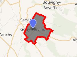 | |
) Gouy-Servins ) Gouy-Servins | |
| Coordinates: 50°24′14″N 2°39′02″E / 50.4039°N 2.6506°E | |
| Country | France |
| Region | Hauts-de-France |
| Department | Pas-de-Calais |
| Arrondissement | Lens |
| Canton | Bully-les-Mines |
| Intercommunality | CA Lens-Liévin |
| Government | |
| • Mayor (2008–2014) | Alain Lherbier |
| Area 1 | 3.32 km2 (1.28 sq mi) |
| Population (Jan. 2017)[1] | 344 |
| • Density | 100/km2 (270/sq mi) |
| Time zone | UTC+01:00 (CET) |
| • Summer (DST) | UTC+02:00 (CEST) |
| INSEE/Postal code | 62380 /62530 |
| Elevation | 124–171 m (407–561 ft) (avg. 160 m or 520 ft) |
| 1 French Land Register data, which excludes lakes, ponds, glaciers > 1 km2 (0.386 sq mi or 247 acres) and river estuaries. | |
Gouy-Servins is a commune in the Pas-de-Calais department in the Hauts-de-France region of France.
Geography
A small farming village situated some 10 miles (16.1 km) west of Lens, at the junction of the D57 and the D75.
Population
| Year | 1962 | 1968 | 1975 | 1982 | 1990 | 1999 | 2004 |
|---|---|---|---|---|---|---|---|
| Population | 212 | 239 | 217 | 242 | 288 | 297 | 299 |
| From the year 1962 on: No double counting—residents of multiple communes (e.g. students and military personnel) are counted only once. | |||||||
Places of interest
- The church of St.Roch, dating from the sixteenth century.
- The war memorial and the CWGC graves.
See also
References
- ^ "Populations légales 2017". INSEE. Retrieved 6 January 2020.
External links