Glandage | |
|---|---|
) Town hall | |
Location of Glandage 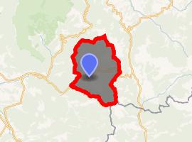 | |
) Glandage ) Glandage | |
| Coordinates: 44°41′20″N 5°35′56″E / 44.6889°N 5.5989°E | |
| Country | France |
| Region | Auvergne-Rhône-Alpes |
| Department | Drôme |
| Arrondissement | Die |
| Canton | Le Diois |
| Intercommunality | Diois |
| Government | |
| • Mayor (2008–2014) | René Orand |
| Area 1 | 52.11 km2 (20.12 sq mi) |
| Population (Jan. 2017)[1] | 113 |
| • Density | 2.2/km2 (5.6/sq mi) |
| Demonym(s) | glandageois |
| Time zone | UTC+01:00 (CET) |
| • Summer (DST) | UTC+02:00 (CEST) |
| INSEE/Postal code | 26142 /26410 |
| Elevation | 717–2,045 m (2,352–6,709 ft) |
| 1 French Land Register data, which excludes lakes, ponds, glaciers > 1 km2 (0.386 sq mi or 247 acres) and river estuaries. | |
Glandage is a commune in the Drôme department in southeastern France.
Population
| Year | Pop. | ±% |
|---|---|---|
| 1911 | 439 | — |
| 1962 | 75 | −82.9% |
| 1968 | 99 | +32.0% |
| 1975 | 83 | −16.2% |
| 1982 | 121 | +45.8% |
| 1990 | 111 | −8.3% |
| 1999 | 84 | −24.3% |
| 2008 | 93 | +10.7% |
See also
- Communes of the Drôme department
- Parc naturel régional du Vercors
References
- ^ "Populations légales 2017". INSEE. Retrieved 6 January 2020.