| George Town Council Tasmania | |||||||||||||||
|---|---|---|---|---|---|---|---|---|---|---|---|---|---|---|---|
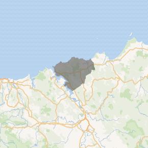 Map showing the George Town local government area. | |||||||||||||||
| Coordinates | 41°06′06″S 147°01′30″E / 41.1018°S 147.0251°E | ||||||||||||||
| Population | 6,931 (2018)[1] | ||||||||||||||
| • Density | 10.614/km2 (27.490/sq mi) | ||||||||||||||
| Established | 1 January 1907[2] | ||||||||||||||
| Area | 653 km2 (252.1 sq mi)[1] | ||||||||||||||
| Mayor | Greg Kieser | ||||||||||||||
| Council seat | George Town | ||||||||||||||
| Region | East Tamar Valley | ||||||||||||||
| State electorate(s) | Bass | ||||||||||||||
| Federal Division(s) | Bass | ||||||||||||||
| Website | George Town Council | ||||||||||||||
| |||||||||||||||
)
George Town Council is a local government body in northern Tasmania, situated north of Launceston. The George Town local government area is classified as rural and has a population of 6,931,[1] it encompasses the principal town, George Town, and the nearby localities including Hillwood, Low Head and Pipers River.
History and attributes
The George Town municipality was established on 1 January 1907.[2] George Town is classified as rural, agricultural and large (RAL) under the Australian Classification of Local Governments.[3]
Suburbs
| Suburb | Census population 2016 | Reason |
|---|---|---|
| George Town | 4347 | Includes Pipe Clay Bay |
| Pipe Clay Bay | Incl. in George Town | |
| Low Head | 572 | |
| Bell Bay | 0 | |
| Long Reach | 0 | |
| Hillwood | 578 | |
| Mount Direction | 246 | |
| Lower Turners Marsh | 37 | |
| Pipers River | 426 | |
| Pipers Brook | 93 | |
| Bellingham | 60 | |
| Retreat | 18 | |
| Weymouth | 129 | |
| Lulworth | 165 | |
| Beechford | 90 | |
| Stony Head | 0 | |
| Lefroy | 76 | |
| Back Creek | ||
| Total | 6,837 | |
| (73) | Variance | |
| Local government total | 6,764 | Gazetted George Town Local Government Area |
See also
- List of local government areas of Tasmania
References
- ^ a b c "3218.0 – Regional Population Growth, Australia, 2017-18: Population Estimates by Local Government Area (ASGS 2018), 2017 to 2018". Australian Bureau of Statistics. Australian Bureau of Statistics. 27 March 2019. Retrieved 25 October 2019. Estimated resident population, 30 June 2018.
- ^ a b "Agency Details: George Town Municipal Council". search.archives.tas.gov.au. Tasmanian Government. Retrieved 11 June 2018.
- ^ "Local government national report 2014-2015". regional.gov.au. Australian Government. Retrieved 8 June 2018.
- ^ Australian Bureau of Statistics. "2011 Census QuickStats". Retrieved 23 July 2017.