) | |
| Location | Garve, Highland Scotland |
| Coordinates | 57°36′47″N 4°41′18″W / 57.6130°N 4.6883°W |
| Grid reference | NH395613 |
| Managed by | Abellio ScotRail |
| Platforms | 2 |
| Other information | |
| Station code | GVE |
| History | |
| Original company | Dingwall and Skye Railway |
| Pre-grouping | Highland Railway |
| Post-grouping | LMS |
| Key dates | |
| 19 August 1870 | Opened[2] |
| Passengers | |
| 2015/16 | |
| 2016/17 | |
| 2017/18 | |
| 2018/19 | |
| 2019/20 | |
| Location | |
 | |
| Notes | |
Passenger statistics from the Office of Rail and Road | |
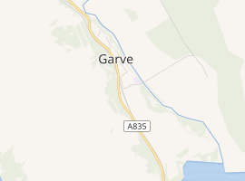
Garve railway station is a railway station on the Kyle of Lochalsh Line, serving the village of Garve in the north of Scotland. Garve is located at the eastern edge of Loch Garve. It was to be the junction for the Garve and Ullapool Railway, intended to connect Ullapool, the Western Isles' nearest mainland port, with the rest of the UK. An act of parliament was passed for the line in 1890, but in spite of local efforts in that year, and again two years later, the idea could not be fully financed and was abandoned.
The station is 11 miles 65 chains (19.0 km) from Dingwall, and has a passing loop 20 chains (400 m) long, flanked by two platforms which can each accommodate a five-coach train.[3]
The first of the Kyle line's three passing loops is located here and trains are occasionally timetabled to cross, though the loop points work automatically and all movements are controlled using the Radio Electronic Token Block system which was installed by British Rail and is supervised from the signalling centre at Inverness.
Services
From Monday to Saturday, there are four daily services to Kyle of Lochalsh and four daily services in the opposite direction to Inverness. There is one service in each direction on Sundays all year, with a second during the summer months only.[4]
| Preceding station | Following station | |||
|---|---|---|---|---|
| Dingwall | Abellio ScotRail Kyle of Lochalsh Line | Lochluichart | ||
| Achterneed | Highland Railway Dingwall and Skye Railway | Lochluichart | ||
References
Notes
- ^ Brailsford (2017), Gaelic/English Station Index.
- ^ Butt (1995), p. 101.
- ^ Brailsford (2017), map 22F.
- ^ GB National Rail Timetable 15 May - 10 December 2016, Table 239
Sources
- Brailsford, Martyn, ed. (December 2017) [1987]. Railway Track Diagrams 1: Scotland & Isle of Man (6th ed.). Frome: Trackmaps. ISBN 978-0-9549866-9-8.
- Butt, R. V. J. (1995). The Directory of Railway Stations: details every public and private passenger station, halt, platform and stopping place, past and present (1st ed.). Sparkford: Patrick Stephens Ltd. ISBN 978-1-85260-508-7. OCLC 60251199.
- Jowett, Alan (2000). Jowett's Nationalised Railway Atlas (1st ed.). Penryn, Cornwall: Atlantic Transport Publishers. ISBN 978-0-906899-99-1. OCLC 228266687.
- Jowett, Alan (March 1989). Jowett's Railway Atlas of Great Britain and Ireland: From Pre-Grouping to the Present Day (1st ed.). Sparkford: Patrick Stephens Ltd. ISBN 978-1-85260-086-0. OCLC 22311137.
External links
- "Garve station on navigable O.S. map".
- "Dingwall and Skye Railway". RailScot. Retrieved 2 February 2011.