| Francis Marion National Forest | |
|---|---|
) Palmetto Trail | |
) | |
| Location | South Carolina, United States |
| Nearest city | Charleston, SC |
| Coordinates | 33°10′00″N 79°40′00″W / 33.166667°N 79.666667°W |
| Area | 258,864 acres (1,047.59 km2)[1] |
| Established | July 10, 1936[2] |
| Governing body | U.S. Forest Service |
| Website | Francis Marion and Sumter National Forests |
The Francis Marion National Forest is located north of Charleston, South Carolina. It is named for revolutionary war hero Francis Marion, who was known to the British as the Swamp Fox. It lies entirely within the Middle Atlantic coastal forests ecoregion.[3] The park is also entirely in the Subtropical coniferous forest.
This National Forest is contained entirely in the counties of Charleston and Berkeley and is 258,864 acres (1,050 km2) in size. The forest contains the towns of Awendaw, Huger, Jamestown, and McClellanville. Charleston provides emergency services to the southeastern portions of the forest. Forest headquarters are located in Columbia, together with those of Sumter National Forest. There are local ranger district offices located in Cordesville.
In 1989, the forest was nearly destroyed by Hurricane Hugo; only the young growth survived the storm and its aftermath. Today, most trees in the forest do not predate this hurricane.
The forest is a multiple use area. Recreation opportunities include campsites, rifle ranges, boat ramps, and several trails for hiking, horseback riding, mountain biking, including the Palmetto Trail, as well as off-road motorcycling and atv riding specifically at the Wambaw Cycle Trailhead. (OHV) The Forest Service also administers wilderness areas, experimental forests, timber production, and protection and management of wildlife and the watershed.
Wilderness areas
There are four officially designated wilderness areas lying within Francis Marion National Forest that are part of the National Wilderness Preservation System.
- Hell Hole Bay Wilderness
- Little Wambaw Swamp Wilderness
- Wambaw Creek Wilderness
- Wambaw Swamp Wilderness
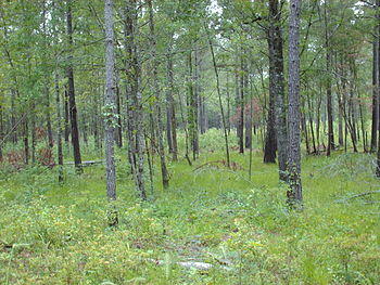
An image of the forest next to the Santee River in Berkeley County.
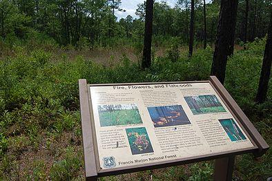
Information in Palmetto Trail.
)
)
Bibliography
- ^ "Land Areas of the National Forest System" (PDF). U.S. Forest Service. January 2012. Retrieved June 30, 2012.
- ^ "The National Forests of the United States" (PDF). ForestHistory.org. Retrieved July 30, 2012.
- ^ Olson, D. M, E. Dinerstein; et al. (2001). "Terrestrial Ecoregions of the World: A New Map of Life on Earth". BioScience. 51 (11): 933–938. doi:10.1641/0006-3568(2001)051[0933:TEOTWA]2.0.CO;2. Archived from the original on 2011-10-14.
- Jerman, Patricia (2000). South Carolina Nature Viewing Guide. Charleston: University of South Carolina Press.
- (1941). South Carolina: A Guide to the Palmetto State. New York: Oxford University Press.
External links
![]() Media related to Francis Marion National Forest at Wikimedia Commons
Media related to Francis Marion National Forest at Wikimedia Commons