Dikili | |
|---|---|
Town | |
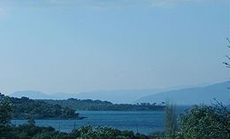
_Dikili_Turkey.jpg) The ancient site of Atarna (Atarneus) and a view of the plain near Dikili | |
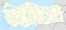
 Location of Dikili within Turkey. | |
| Coordinates: 39°4′N 26°53′E / 39.067°N 26.883°E | |
| Country | |
| Region | Aegean |
| Province | İzmir |
| Mayor | Mustafa Tosun |
| Area | |
| • District | 509.60 km2 (196.76 sq mi) |
| Population (2012)[2] | |
| • Urban | 18,669 |
| • District | 35,230 |
| • District density | 69/km2 (180/sq mi) |
| Time zone | UTC+2 (EET) |
| • Summer (DST) | UTC+3 (EEST) |
| Postal code | 35x xx |
| Area code(s) | 0232 |
| Licence plate | 35 |
| Website | izmir-dikili.bel.tr |
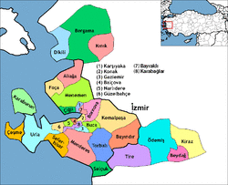
Dikili is a coastal town and a district of İzmir Province in the Aegean Region of Turkey. The district is quite picturesque both along its shoreline and in its inland parts, and is a popular summer resort. The central town of Dikili is situated at about 120 km (75 mi) north of İzmir, served by a good road. The notable township of Çandarlı (ancient Pitane) is located close to Dikili.
History
The ancient and as yet unexplored site of Atarneus is located nearby. The site is called "Atarna" locally.
Dikili is the birthplace of the Greek American left-wing activist and artist Aristodimos Kaldis (1899 – 1979) and the Greek archaeologist Efstratios Pelekidis (1880/1882 - 1958).
Geography
Dikili town centre is situated opposite the Greek island of Lesbos. A small islet within Dikili district (called Garip Adası locally, with ancient sources also citing the name Argounissai) made international headlines in April 2007. The islet was offered for sale by its proprietors and The Guardian reported the Greek islanders of Lesbos raising money among themselves to buy the islet.[3]
Important places
There is a crater lake in Merdivenli village, and ancient caverns in Demirtaş and Deliktaş villages, as well as pine forests extending towards the Madra Stream. There are thermal springs, which are in Nebiler, Bademli and Kocaoba villages. There are also beaches in Bademli and Denizköy. The Merkez Mosque is a rare example of a wooden construction dating from 1789. It was built without using any nails in the construction.[4]
See also
- Atarneus
- Garip Island
References
- ^ "Area of regions (including lakes), km²". Regional Statistics Database. Turkish Statistical Institute. 2002. Retrieved 2013-03-05.
- ^ "Population of province/district centers and towns/villages by districts - 2012". Address Based Population Registration System (ABPRS) Database. Turkish Statistical Institute. Retrieved 2013-02-27.
- ^ "Greeks plan to buy Turkish island". Retrieved 2007-04-02.
- ^ "Dikili Guide". Archived from the original on 2007-02-05. Retrieved 2007-01-26.
External links
http://www.izmir-dikili.bel.tr/


