Dehui 德惠市 | |||||||||||||||||||||||||||||||||
|---|---|---|---|---|---|---|---|---|---|---|---|---|---|---|---|---|---|---|---|---|---|---|---|---|---|---|---|---|---|---|---|---|---|
Dehui 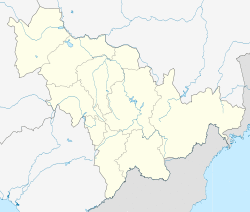 Location in Jilin | |||||||||||||||||||||||||||||||||
| Coordinates: 44°32′06″N 125°42′11″E / 44.535°N 125.703°E[1] | |||||||||||||||||||||||||||||||||
| Country | People's Republic of China | ||||||||||||||||||||||||||||||||
| Province | Jilin | ||||||||||||||||||||||||||||||||
| Sub-provincial city | Changchun | ||||||||||||||||||||||||||||||||
| Divisions | 4 subdistricts 10 towns 4 townships | ||||||||||||||||||||||||||||||||
| Seat | Shengli Subdistrict (胜利街道) | ||||||||||||||||||||||||||||||||
| Area | |||||||||||||||||||||||||||||||||
| • County-level city | 3,439.2 km2 (1,327.9 sq mi) | ||||||||||||||||||||||||||||||||
| • Urban | 124.83 km2 (48.20 sq mi) | ||||||||||||||||||||||||||||||||
| Population (2010)[3] | |||||||||||||||||||||||||||||||||
| • County-level city | 748,369 | ||||||||||||||||||||||||||||||||
| • Estimate (2017) | 932,000 | ||||||||||||||||||||||||||||||||
| • Density | 220/km2 (560/sq mi) | ||||||||||||||||||||||||||||||||
| • Urban | 250,000 | ||||||||||||||||||||||||||||||||
| Time zone | UTC+8 (China Standard) | ||||||||||||||||||||||||||||||||
| Postal code | 1303XX | ||||||||||||||||||||||||||||||||
| Changchun district map |
| ||||||||||||||||||||||||||||||||

Dehui (Chinese: 德惠; pinyin: Déhuì) is a county-level city of Jilin Province, Northeast China, it is under the administration of the prefecture-level city of Changchun, located in the middle of the Songliao Plain. It has a total population of 906,000 and a rural population of 753,000. Composed of 10 towns, four townships and four subdistricts, under which there are 308 villages, it is around 80 kilometres (50 mi) north-northeast of central Changchun. It borders Yushu to the northeast, Jiutai to the south, Kuancheng District to the southwest, Nong'an County to the west, as well as the prefecture-level cities of Jilin to the southeast and Songyuan to the northwest.
Administrative divisions
Subdistricts:[4]
- Shengli Subdistrict (胜利街道), Jianshe Subdistrict (建设街道), Huifa Subdistrict (惠发街道), Xiajiadian Subdistrict (夏家店街道)
Towns:
- Daqingzui (大青嘴镇), Guojia (郭家镇), Songhuajiang (松花江镇), Dajiagou (达家沟镇), Dafangshen (大房身镇), Chalukou (岔路口镇), Zhuchengzi (朱城子镇), Buhai (布海镇), Tiantai (天台镇), Caiyuanzi (菜园子镇)
Townships:
- Tongtai Township (同太乡), Biangang Township (边岗乡), Wutai Township (五台乡), Chaoyang Township (朝阳乡)
References
- ^ Google (2014-07-02). "Dehui" (Map). Google Maps. Google. Retrieved 2014-07-02.
- ^ a b Ministry of Housing and Urban-Rural Development, ed. (2019). China Urban Construction Statistical Yearbook 2017. Beijing: China Statistics Press. p. 50. Retrieved 11 January 2020.
- ^ 2010 Census county-by-county statistics (《中国2010年人口普查分县资料》). Accessed 8 July 2014.
- ^ 2011年统计用区划代码和城乡划分代码:东台市 (in Chinese). National Bureau of Statistics of the People's Republic of China. Archived from the original on 2013-10-07. Retrieved 2013-06-03.
External links