Cuyuni-Mazaruni Region 7 | |
|---|---|
Administrative Region | |
) | |
) Map of Guyana showing Cuyuni-Mazaruni region | |
| Country | |
| Regional Capital | Bartica |
| Area | |
| • Total | 47,213 km2 (18,229 sq mi) |
| Population (2012 census) | |
| • Total | 20,280 |
| • Density | 0.43/km2 (1.1/sq mi) |
| [2] | |
Cuyuni-Mazaruni (Region 7) is a region of Guyana. Venezuela claims the territory as part of Guayana Esequiba.
It borders the regions of Barima-Waini, Essequibo Islands-West Demerara and Pomeroon-Supenaam to the north, the region of Upper Demerara-Berbice to the east, the region of Potaro-Siparuni and Brazil to the south.
Its capital is Bartica, with other towns including Issano, Kartuni, Kamarang, Keweigek, and Imbaimadai.
It covers an area of 47,213 km². Before the 1980 administrative reform most of the area belonged to the Mazaruni-Potaro district.[3]
Population
The Government of Guyana has administered three official censuses since the 1980 administrative reforms, in 1980, 1991 and 2002.[4] In 2012, the population of Cuyuni-Mazaruni was recorded at 20,280 people.[5] Official census records for the population of the Cuyuni-Mazaruni Region are as follows:
- 2012 : 20,280
- 2002 : 17,597
- 1991 : 14,794
- 1980 : 14,390
Communities
(including name variants):
- Ajimipepai
- Akar (Akar Village)
- Amamure Village (Amamuri Village)
- Amokokopai (Amokokopai Village)
- Apanachi
- Arau (Arau Village)
- Arawai (Arawai Village)
- Arimu Mine
- Assura (Assura Village)
- Aunama (Aunama Village)
- Aurora
- Awarabati
- Barakara
- Bartica (Barteke)
- Butakari (Butukari)
- Ekereku
- Enachu (Enachu Landing, Enachu Station)
- Golden Grove
- Hororabo
- Imbaimadai
- Issano
- Isseneru
- Kaikan
- Kalacoon (Kalakoon House, Kalakun, Kalkoon)
- Kamarang
- Kamaria
- Kamikusa
- Kamuda (Kamuda Village)
- Kartabo
- Kartuni
- Kaywaek (Kaywaek Village)
- Keweigek
- Klip
- Kokadai
- Kowaeng (Kowaeng Village)
- Kurachi
- Kurupung
- Kurutuku (Kurutuku Village)
- Kwiokrebaru
- Lower Kamaria
- Meruwang
- Minata
- Mongreppo
- Morowta
- Muriakundi (Muruakundi)
- Muruwawe (Muruwawe Village)
- Opadai
- Oranapai (Oranapai Landing, Oranopai)
- Paruima (Paruima Mission)
- Pathawaru
- Peters Mine
- Pipillipai
- Poterima
- Saint Edwards Mission
- Saint Marys (Saint Mary's)
- The Clip
- Tumereng (Tumareng, Tumureng)
- Upper Kamaria
- Waioklepalul (Waioklepaluta Village)
- Waramadong (Waramadong Village, Waramdan)
- Wineperu
- Wolga
Gallery
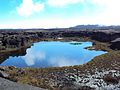
Gladys Lake
.jpg)
Bartica
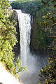
Kamarang Great falls
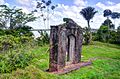
Fort Kai-Kover-All
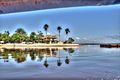
Vulture Resort
)
.jpg'))
)
)
)
See also
References
- ^ "Official Announcements". Archived from the original on 8 September 2016. Retrieved 28 July 2016.
- ^ Macmillan Publishers (2009). "Administrative Regions - 1 and 7". Macmillan Junior Atlas: Guyana. Oxford: Macmillan Caribbean. p. 36. ISBN 9780333934173.
- ^ "Guyana Regions". Statoids. Retrieved 19 August 2020.
- ^ Beaie, Sonkarley Tiatun (19 September 2007). "Chapter 3: National Redistribution and Internal Migration" (PDF). 2002 Population and Housing Census - Guyana National Report. Bureau of Statistics. p. 51. Archived from the original (PDF) on 2 September 2012. Retrieved 29 August 2012.
- ^ Beaie, Sonkarley Tiatun (19 September 2007). "National Population Trends: Size, Growth and Distribution" (PDF Download). 2002 Population and Housing Census - Guyana National Report. Bureau of Statistics. p. 25. Retrieved 29 August 2012.