| Cumbal | |
|---|---|
| Volcán Cumbal | |
) Cumbal in 2011 | |
| Highest point | |
| Elevation | 4,764 m (15,630 ft) |
| Prominence | 1,575 m (5,167 ft) |
| Listing | Ultra |
| Coordinates | 0°56′56″N 77°53′17″W / 0.949°N 77.888°W |
| Geography | |
) Cumbal Location of Cumbal in Colombia | |
| Location | Colombia |
| Parent range | Nudo de los Pastos, Western Ranges Andes |
| Geology | |
| Mountain type | Andesitic stratovolcano |
| Last eruption | December 1926 |
Cumbal is a stratovolcano of the Caribe Terrane, located at the Nudo de los Pastos in Nariño, Colombia. It is the southernmost historically active volcano of Colombia and is together with Chiles and Azufral one of the few volcanoes of the Western Ranges. The volcano is dominated by andesites.[1]
Plane crash
The volcano was the crash site of TAME Flight 120, which struck one of its sides while in a go-around approach to Tulcán on January 28, 2002. There were no survivors among the 94 occupants.
Gallery
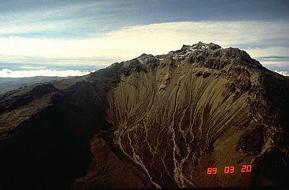
1989
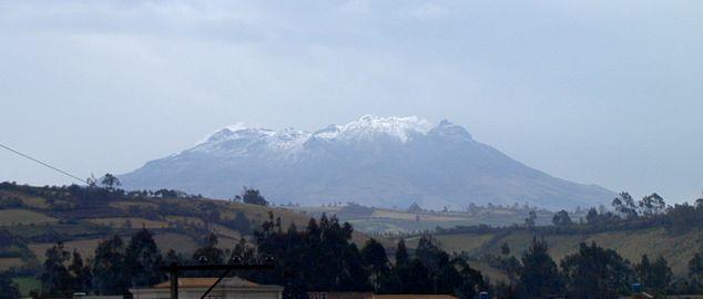
2007
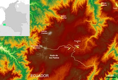
Nudo de los Pastos
)
)
See also
- List of volcanoes in Colombia
- List of volcanoes by elevation
References
- ^ Plancha 447-447bis, 2003
Bibliography
- Parra, Eduardo, and Marta Velásquez. 2003. Plancha 447 Ipiales & 447bis Tallambí - 1:100,000, 1. INGEOMINAS. Accessed 2017-06-06.
External links
- "Cumbal". Global Volcanism Program. Smithsonian Institution.