Crnl. FAP Carlos Ciriani Santa Rosa International Airport | |||||||||||
|---|---|---|---|---|---|---|---|---|---|---|---|
| |||||||||||
| Summary | |||||||||||
| Airport type | Public | ||||||||||
| Operator | CORPAC S.A. | ||||||||||
| Location | Tacna, Peru | ||||||||||
| Elevation AMSL | 1,538 ft / 469 m | ||||||||||
| Coordinates | 18°03′05″S 70°16′30″W / 18.05139°S 70.27500°W | ||||||||||
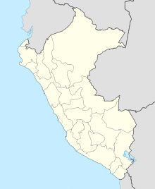
| Map | |||||||||||
| Runways | |||||||||||
| |||||||||||
Coronel FAP Carlos Ciriani Santa Rosa International Airport (IATA: TCQ, ICAO: SPTN) is an airport serving Tacna, Peru. It is run by CORPAC S.A. (Corporación Peruana de Aeropuertos y Aviación Comercial S.A.), a government organization that oversees airport management. The airport is the main airport of the Tacna Region, and is 27 km (17 mi) north of Peru's border with Chile.
The Tacna VOR-DME (Ident: TCA) and non-directional beacon (Ident: TNA) are located on the field.[3][4]
Airlines and destinations
| Airlines | Destinations |
|---|---|
| LATAM Perú | Lima |
| Viva Air Perú | Lima |
See also
- Transport in Peru
- List of airports in Peru
References
- ^ Airport information for Tacna Airport at Great Circle Mapper.
- ^ "Google Maps". Google Maps. Retrieved Mar 29, 2019.
- ^ "SkyVector: Flight Planning / Aeronautical Charts". skyvector.com. Retrieved Mar 29, 2019.
- ^ "Tacna VOR-DME (TCA) @ OurAirports". ourairports.com. Retrieved Mar 29, 2019.
External links
- Airport information for SPTN at World Aero Data. Data current as of October 2006.
- OpenStreetMap - Tacna
- SkyVector Aeronautical Charts
- OurAirports - Tacna
- Accident history for Tacna at Aviation Safety Network
