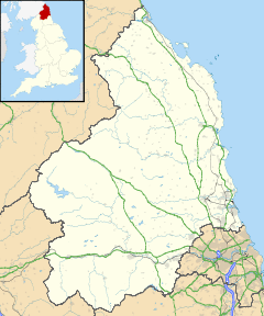
| Colpitts Grange | |
|---|---|
 | |
Location within Northumberland | |
| OS grid reference | NY985555 |
| Unitary authority |
|
| Ceremonial county | |
| Region | |
| Country | England |
| Sovereign state | United Kingdom |
| Post town | HEXHAM |
| Postcode district | NE47 |
| Police | Northumbria |
| Fire | Northumberland |
| Ambulance | North East |
| UK Parliament | |
Colpitts Grange is a village in Northumberland, England.[1] It is about 10 miles (16 km) to the south-east of Hexham.
Governance
Colpitts Grange is in the parliamentary constituency of Hexham.[2]
References
- ^ Ordnance Survey: Landranger map sheet 87 Hexham & Haltwhistle (Map). Ordnance Survey. 2009. ISBN 9780319231678.
- ^ "Ordnance Survey Election Maps". www.ordnancesurvey.co.uk. Ordnance Survey. Archived from the original on 20 February 2016. Retrieved 3 April 2016.
External links
![]() Media related to Colpitts Grange at Wikimedia Commons
Media related to Colpitts Grange at Wikimedia Commons
