Castilho | |
|---|---|
Municipality | |
) Flag ) Coat of arms | |
| Nickname(s): Paraíso do Pescador[1] (Fisherman's Paradise) | |
| Motto(s): Eripuit Coelo Fulmen (Snatched the Lightning From the Sky)[2] | |
| Anthem: Hino do município de Castilho | |
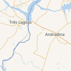 Interactive map outlining Castilho | |
) Location within the State of São Paulo | |
) Castilho Location within the State of São Paulo ) Castilho Location within Brazil ) Castilho Location within South America | |
| Coordinates: 20°52′20″S 51°29′15″W / 20.87222°S 51.48750°W | |
| Country | |
| Region | Southeast |
| State | |
| Mesoregion | Araçatuba |
| Microregion | Andradina |
| Founded | 10 August 1934[1] |
| Incorporated | 30 December 1953[3] |
| Founded by | Armel Miranda[4] |
| Named for | Alfredo de Castilho[5] |
| Government | |
| • Type | Mayor–council |
| • Mayor | Aparecida de Fátima Gavioli Nascimento (DEM) |
| • Municipal Chamber | Councilors |
| Area | |
| • Municipality | 1,065.318 km2 (411.322 sq mi) |
| Area rank | 1,359th, Brazil |
| Highest elevation [9] (Urban area) | 378.46 m (1,241.67 ft) |
| Lowest elevation [9] (Pontal) | 263.09 m (863.16 ft) |
| Population | |
| • Municipality | 18,003 |
| • Estimate (2020)[8] | 21,267 |
| • Rank | 1,839th, Brazil |
| • Density | 16.89/km2 (43.7/sq mi) |
| • Urban | 13,586 |
| • Rural | 4,417 |
| Demonym(s) | castilhense[8][12] |
| Ethnicity | |
| • White | 54.42% (9,797 inhabitants) |
| • Pardo | 40.11% (7,220 inhabitants) |
| • Black | 4.16% (749 inhabitants) |
| • Yellow | 1.29% (231 inhabitants) |
| • Indian | 0.03% (5 inhabitants) |
| Time zone | UTC−03:00 (BRT) |
| • Summer (DST) | UTC−02:00 (BRST) |
| Postal codes | 16920-000 |
| Area code(s) | 18[14] |
| HDI (2010)[15] | 0.731 – high |
| Website | Official website |
Castilho (Portuguese pronunciation: [kas.ˈti.ʎu]) is a municipality in the state of São Paulo, in Brazil. It has an estimated population of 21,267 (as of 2020)[8] in an area of 1,065.318 km2 (411 sq mi),[7] and its elevation is of 378.46 m (1,242 ft) above the sea level.[9]
The municipality contains 3.69% of the 9,044 hectares (22,350 acres) from the Aguapeí State Park, created in 1998.[16] It contains part of the 8,885.33 hectares (21,956.1 acres) from the Mouth of the Aguapeí Private Natural Heritage Reserve, created in 2010.[17]
References
- ^ a b c "Município de Castilho" [Castilho Municipality]. Prefeitura do Município de Castilho/SP [Castilho/SP City Hall] (in Portuguese). Retrieved 22 December 2020.
- ^ "LEI nº. 362, de 16 de fevereiro de 1973" [LAW no. 362, of 16 February 1973] (PDF). Câmara Municipal de Castilho [Municipal Chamber of Castilho] (in Portuguese). Webline Sistemas. Retrieved 21 December 2020.
The motto "ERIPUIT COELO FULMEN", which can be read in the scroll, is translated as "SNATCHED THE LIGHTNING FROM THE SKY", constituting an eloquent statement of Castilho, having mastered the electric energy and strew the benefits for the common good.
- ^ "LEI N. 2.456, DE 30 DE DEZEMBRO DE 1953" [LAW NO. 2,456, OF 30 DECEMBER 1953]. Assembleia Legislativa do Estado de São Paulo [Legislative Assembly of the State of São Paulo] (in Portuguese). Retrieved 22 December 2020.
The municipality of Castilho is created, with seat in the village of the same name and with the territory from the respective district.
- ^ "IBGE | Cidades@ | São Paulo | Castilho | História & Fotos" [IBGE | Cities@ | São Paulo | Castilho | History & Photos]. Instituto Brasileiro de Geografia e Estatística [Brazilian Institute of Geography and Statistics] (in Portuguese). Retrieved 22 December 2020.
- ^ "Quem foi ALFREDO DE CASTILHO?" [Who was ALFREDO DE CASTILHO?]. Prefeitura do Município de Castilho/SP [Castilho/SP City Hall] (in Portuguese). Retrieved 22 December 2020.
- ^ "VEREADORES" [COUNCILORS]. Câmara Municipal de Castilho [Municipal Chamber of Castilho] (in Portuguese). Webline Sistemas. Retrieved 22 December 2020.
- ^ a b "Castilho (SP) | Cities and States | IBGE". Instituto Brasileiro de Geografia e Estatística [Brazilian Institute of Geography and Statistics]. Retrieved 21 December 2020.
- ^ a b c d e "IBGE | Cidades@ | São Paulo | Castilho | Panorama" [IBGE | Cities@ | São Paulo | Castilho | Panorama]. Instituto Brasileiro de Geografia e Estatística [Brazilian Institute of Geography and Statistics] (in Portuguese). Retrieved 22 December 2020.
- ^ a b c "BR Localidades 2010 v1" [BR Locations 2010 v1] (MDB). Instituto Brasileiro de Geografia e Estatística [Brazilian Institute of Geography and Statistics] (in Portuguese). Retrieved 24 August 2016.
- ^ "CENSO 2010 – SÃO PAULO" [2010 CENSUS – SÃO PAULO] (PDF). Instituto Brasileiro de Geografia e Estatística [Brazilian Institute of Geography and Statistics] (in Portuguese). Archived from the original (PDF) on 24 January 2011. Retrieved 22 December 2020.
- ^ a b "IBGE | Cidades@ | São Paulo | Castilho | Pesquisa | Censo | Sinopse" [IBGE | Cities@ | São Paulo | Castilho | Research | Census | Synopsis]. Instituto Brasileiro de Geografia e Estatística [Brazilian Institute of Geography and Statistics] (in Portuguese). Retrieved 21 December 2020.
- ^ "Dicionário Online - Dicionário Caldas Aulete - Significado de castilhense" [Online Dictionary - Caldas Aulete Dictionary - Meaning of castilhense]. iDicionário Aulete [iDictionary Aulete] (in Portuguese). Lexikon Editora Digital. Retrieved 22 December 2020.
- ^ "Tabela 2093 – População residente por cor ou raça, sexo, situação do domicílio e grupos de idade – Amostra – Características Gerais da População" [Table 2093 – Resident population by color or race, sex, state of domicile and age groups – Sample – General Characteristics of the Population]. Sistema IBGE de Recuperação Automática [Brazilian Institute of Geography and Statistics System of Automatic Recovery] (in Portuguese). Retrieved 20 December 2020.
- ^ "CÓDIGOS DE SÃO PAULO" [SÃO PAULO CODES] (PDF). Agência Nacional de Telecomunicações [National Agency of Telecommunications] (in Portuguese). Retrieved 23 December 2020.
- ^ "Ranking IDHM Municípios 2010" [MHDI Ranking Municipalities 2010]. Programa das Nações Unidas para o Desenvolvimento Brasil [United Nations Development Programme Brazil] (in Portuguese). Retrieved 9 February 2019.
- ^ "Parque Estadual do Aguapeí" [Aguapeí State Park]. Unidades de Conservação no Brasil [Conservation Areas in Brazil]. Instituto Socioambiental. Retrieved 22 February 2020.
- ^ "RPPN SP 2013 – Anuário das Reservas Particulares do Patrimônio Natural Instituídas pela Secretaria do Meio Ambiente do Estado de São Paulo" [PRNH SP 2013 – Yearbook of Private Reserves of Natural Heritage Established by the Secretariat for the Environment of the State of São Paulo] (PDF). Secretaria do Meio Ambiente do Estado de São Paulo [Secretariat for the Environment of the State of São Paulo] (in Portuguese). p. 49. Archived from the original (PDF) on 28 October 2015. Retrieved 22 December 2020.