Capian | |
|---|---|
) The town hall in Capian | |
.svg.jpg')) Coat of arms | |
Location of Capian 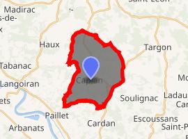 | |
) Capian ) Capian | |
| Coordinates: 44°42′42″N 0°19′47″W / 44.7117°N 0.3297°W | |
| Country | France |
| Region | Nouvelle-Aquitaine |
| Department | Gironde |
| Arrondissement | Langon |
| Canton | L'Entre-Deux-Mers |
| Government | |
| • Mayor (2008–2014) | Frédéric Lataste |
| Area 1 | 18.23 km2 (7.04 sq mi) |
| Population (Jan. 2017)[1] | 721 |
| • Density | 40/km2 (100/sq mi) |
| Time zone | UTC+01:00 (CET) |
| • Summer (DST) | UTC+02:00 (CEST) |
| INSEE/Postal code | 33093 /33550 |
| Elevation | 17–115 m (56–377 ft) (avg. 110 m or 360 ft) |
| 1 French Land Register data, which excludes lakes, ponds, glaciers > 1 km2 (0.386 sq mi or 247 acres) and river estuaries. | |
Capian is a commune in the Gironde department in Nouvelle-Aquitaine in southwestern France.
It is located southwest of Bordeaux on the Garonne river. The commune is in the middle of the Bordeaux wine appellation AOC Premieres Cotes de Bordeaux. Many of the villagers own or work in wineries.
Population
| Year | Pop. | ±% |
|---|---|---|
| 1962 | 564 | — |
| 1968 | 623 | +10.5% |
| 1975 | 591 | −5.1% |
| 1982 | 669 | +13.2% |
| 1990 | 602 | −10.0% |
| 1999 | 624 | +3.7% |
| 2008 | 620 | −0.6% |
Vineyard
Château Suau (Capian)
See also
References
- ^ "Populations légales 2017". INSEE. Retrieved 6 January 2020.