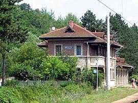
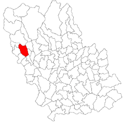
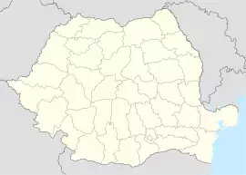
Breaza | |
|---|---|
Town | |
 | |
 Location in Prahova County | |
| Coordinates: 45°11′14″N 25°39′44″E / 45.18722°N 25.66222°E | |
| Country | |
| County | Prahova |
| Government | |
| • Mayor | George Richea[1] (PSD) |
| Area | 50.69 km2 (19.57 sq mi) |
| Population (2011)[2] | 15,928 |
| • Density | 310/km2 (810/sq mi) |
| Time zone | EET/EEST (UTC+2/+3) |
| Vehicle reg. | PH |
| Website | www |
Breaza (Romanian pronunciation: [ˈbre̯aza]) is a town in Prahova County, Muntenia, Romania.
Name
The town's name is derived from a Slavic word, breza, meaning "birch tree".[3]
History
| Year | Pop. | ±% |
|---|---|---|
| 1956 | 11,122 | — |
| 1966 | 12,733 | +14.5% |
| 1977 | 17,583 | +38.1% |
| 1992 | 19,329 | +9.9% |
| 2002 | 18,863 | −2.4% |
| 2011 | 15,928 | −15.6% |
| Source: Census data | ||
The town was first documented in an act of 1503, mentioning a certain trader of Breaza called "Neagoe". In 1622 the land of Breaza was divided between four boyars and in 1717, the new ruler of Wallachia, Nicolae Mavrocordat gave the Breaza estate to boyar Iordache Creţulescu. The land was divided by the agrarian reform of 1921 and in 1935 it was declared a spa.
Geography
The town center consists of at least two former villages, Podu Vadului and Breaza de Sus, which were later merged. Today, ten villages are administratively part of the town: Breaza de Jos, Breaza de Sus, Frăsinet, Gura Beliei, Irimești, Nistorești, Podu Corbului, Podu Vadului, Surdești and Valea Târsei. One of the main occupations is farming, and traditional needlework, but many inhabitants also commute to work in the neighboring towns of Comarnic and Câmpina. Tourism is also important for the local economy, and many locals rent out rooms in the summer months.
Due to its naturally beautiful surroundings, being located among rolling hills, the town has long been popular with inhabitants of Bucharest, who tend to have vacation homes here. Among the people who are rumored to have second residences in Breaza are Adrian Păunescu[4] and Valentin Ceaușescu.
It is also the site of a folk art museum and a military high school.
References
- ^ "Results of the 2016 local elections". Central Electoral Bureau. Retrieved 5 April 2020.
- ^ "Populaţia stabilă pe judeţe, municipii, oraşe şi localităti componenete la RPL_2011" (in Romanian). National Institute of Statistics. Retrieved 4 February 2014.
- ^ Iordan, Iorgu (1963). Toponimia romînească. Bucharest: Editura Academiei Republicii Populare Romîne. p. 80. OCLC 460710897.
- ^ "Păunescu's list of assets (self-declared)". Senat.ro. Retrieved June 29, 2008.

