Bozouls | |
|---|---|
) An aerial view of Bozouls | |
.svg.gif')) Coat of arms | |
Location of Bozouls 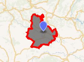 | |
) Bozouls ) Bozouls | |
| Coordinates: 44°28′17″N 2°43′17″E / 44.4714°N 2.7214°E | |
| Country | France |
| Region | Occitanie |
| Department | Aveyron |
| Arrondissement | Rodez |
| Canton | Causse-Comtal |
| Government | |
| • Mayor (2008–2014) | Jean-Luc Calmelly |
| Area 1 | 69.69 km2 (26.91 sq mi) |
| Population (Jan. 2017)[1] | 2,871 |
| • Density | 41/km2 (110/sq mi) |
| Time zone | UTC+01:00 (CET) |
| • Summer (DST) | UTC+02:00 (CEST) |
| INSEE/Postal code | 12033 /12340 |
| Elevation | 355–711 m (1,165–2,333 ft) (avg. 640 m or 2,100 ft) |
| 1 French Land Register data, which excludes lakes, ponds, glaciers > 1 km2 (0.386 sq mi or 247 acres) and river estuaries. | |
Bozouls (Occitan: Boason) is a commune in the Aveyron department in southern France.
It is located on Route Maquis de Jean Pierre (D20) thirty minutes from Rodez, one hour from the Gorges du Tarn, two hours northeast of Toulouse, and six and a half hours due south of Paris.
It sits on the edge of a gorge created by the river Dourdou de Conques.[2]
Population
| Year | Pop. | ±% |
|---|---|---|
| 1990 | 2,060 | — |
| 1999 | 2,230 | +8.3% |
| 2008 | 2,772 | +24.3% |
See also
References
- ^ "Populations légales 2017". INSEE. Retrieved 6 January 2020.
- ^ "French Town Teeters on Edge of 'Hole'". The Weather Channel. Retrieved 13 June 2019.