Bansi | |
|---|---|
Town | |
| Coordinates: 27°10′30″N 82°55′45″E / 27.17500°N 82.92917°E | |
| Country | India |
| State | Uttar Pradesh |
| District | Siddharthnagar |
| Government | |
| • Type | Democracy |
| Elevation | 90 m (300 ft) |
| Population (2011) | |
| • Total | 41,057 |
| Languages | |
| • Official | Hindi, Avadhi |
| Time zone | UTC+5:30 (IST) |
| Vehicle registration | UP-55 |
| Website | sidharthnagar |
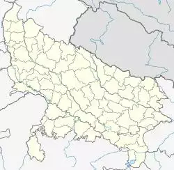
Bansi is a town and a municipal board in Siddharthnagar district in the state of Uttar Pradesh, India Bansi is situated on the bank of Rapti River in Siddharthnagar District.
Overview
The city of Bansi is situated at a distance of 52 kilometers from Basti , 90 kilometers from Gorakhpur and 40 km from Nepal Border. It was the first developed city of the Siddharthnagar district. Before Naugarh (Siddharthnagar) was declared as capital.
Geography
Bansi was located at the bank of river Rapti at 27°10′N 82°56′E / 27.17°N 82.93°E.[1]
Demographics
As of 2011 Indian Census, Bansi Nagar Palika Parishad had a total population of 100000.[2] Males constituted 51% of the population(21,105) and females 49%(19,952). Bansi has an average literacy rate of 58%, lower than the national average of 59.5%; with 61% of the males and 39% of females literate. 18% of the population is under 6 years of age.There are total 6,152 House Holds in Bansi. Total number of workers in Bansi is 11,244 (27%). 7,395 are regular Workers and 3,849 are Irregular Workers.
Travel and connectivity journey
Bansi is well connected to the nearby towns and cities. As it was the center of the activities and many government offices were located at Bansi, it has been well connected to the nearby towns.
Air transport
The nearest Airport is Gorakhpur .
Railways
The nearest railway station is Naugarh (Siddharthnagar). Basti is also one of the near railway stations.[3]
Roads
Roadways (UPSRTC) bus station as well as private bus stand is there. From Bansi regular buses to Siddharthnagar, Gorakhpur, Basti, Khalilabad and Domariyagunj are always available. Also buses to Lucknow, Kanpur, Allahabad, Ayodhya, Faizabad, Akbarpur, Tanda, Rajesultanpur, Azamgarh and Delhi run daily many times from Bansi. Private buses and jeeps are also available for many nearing towns.
References
- ^ "Google Maps". Google Maps. Retrieved 1 February 2018.
- ^ "Bansi (Siddharthnagar, Uttar Pradesh, India) - Population Statistics, Charts, Map, Location, Weather and Web Information". Citypopulation.de. Retrieved 2 November 2019.
- ^ "Nearest Railway Stations to Bansi Uttar Pradesh Uttar Pradesh, Nearby Railway Station & Closest Railway Station to Bansi Uttar Pradesh Uttar Pradesh". Roaddistance.in. Retrieved 2 November 2019.
