Wikipedia

Bad Essen

Bad Essen
Bad Essen
Bad Essen
Coat of arms of Bad Essen
Coat of arms
Location of Bad Essen within Osnabrück district
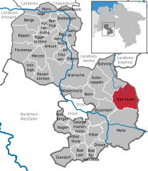
NetherlandsHamburgNorth SeaBremenOsnabrück (district)Lower SaxonyVechta (district)Cloppenburg (district)Diepholz (district)North Rhine-WestphaliaOsnabrückBad LaerGeorgsmarienhütteHilterGlandorfBad IburgDissenBad RothenfeldeHagenHasbergenMelleBissendorfBad EssenBohmteOstercappelnBelmWallenhorstRiesteBramscheAlfhausenGehrdeAnkumBersenbrückNeuenkirchenMerzenVoltlageFürstenauBippenEggermühlenKettenkampNortrupBadbergenBergeMenslageQuakenbrückBad Essen in OS.svg
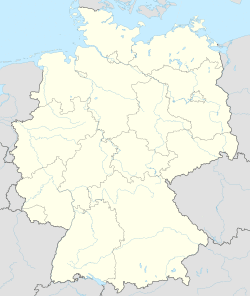
Bad Essen is located in Germany
Bad Essen
Bad Essen
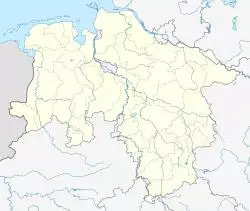
Bad Essen is located in Lower Saxony
Bad Essen
Bad Essen
Coordinates: 52°19′17″N 8°20′24″E / 52.32139°N 8.34000°E
CountryGermany
StateLower Saxony
DistrictOsnabrück
Government
 • MayorTimo Natemeyer (Ind.)
Area
 • Total103.31 km2 (39.89 sq mi)
Elevation
113 m (371 ft)
Population
(2019-12-31)[1]
 • Total15,738
 • Density150/km2 (390/sq mi)
Time zoneUTC+01:00 (CET)
 • Summer (DST)UTC+02:00 (CEST)
Postal codes
49152
Dialling codes05472
Vehicle registrationOS
Websitewww.badessen.de
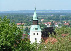
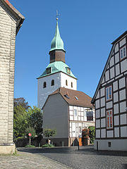
Bad Essen, church: die Sankt Nikolauskirche

Bad Essen is a small municipality and health resort in the district of Osnabrück, in Lower Saxony. Bad Essen with its historical centre is located on the German Timber-Frame Road.

Geography

The town of Bad Essen is on the North German Plains, because of the transition of the low mountain range to the plains. The Wiehengebirge Range covers approximately the southern third of the town and reaches an altitude of 211m above sea level. The highest point of the Wiehengebirge Range is on the black Brink in Lintorf. The northern part of the town is flat, with an average altitude of 50m above sea level. The Hunte flows through the eastern part of Bad Essen northwards and crosses the Midland Canal in Wittlage.

References

External links

Midland Canal in Bad Essen


This article is copied from an article on Wikipedia® - the free encyclopedia created and edited by its online user community. The text was not checked or edited by anyone on our staff. Although the vast majority of Wikipedia® encyclopedia articles provide accurate and timely information, please do not assume the accuracy of any particular article. This article is distributed under the terms of GNU Free Documentation License.

Copyright © 2003-2025 Farlex, Inc Disclaimer
All content on this website, including dictionary, thesaurus, literature, geography, and other reference data is for informational purposes only. This information should not be considered complete, up to date, and is not intended to be used in place of a visit, consultation, or advice of a legal, medical, or any other professional.