Aubenasson | |
|---|---|
.jpg')) A general view of the village of Aubenasson | |
Location of Aubenasson 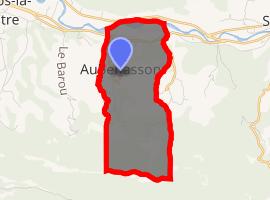 | |
) Aubenasson ) Aubenasson | |
| Coordinates: 44°41′11″N 5°08′24″E / 44.6864°N 5.14°E | |
| Country | France |
| Region | Auvergne-Rhône-Alpes |
| Department | Drôme |
| Arrondissement | Die |
| Canton | Le Diois |
| Intercommunality | CC Crestois et Pays de Saillans |
| Government | |
| • Mayor (2014-2020) | Pascal Moreau |
| Area 1 | 6.69 km2 (2.58 sq mi) |
| Population (Jan. 2017)[1] | 72 |
| • Density | 11/km2 (28/sq mi) |
| Time zone | UTC+01:00 (CET) |
| • Summer (DST) | UTC+02:00 (CEST) |
| INSEE/Postal code | 26015 /26340 |
| Elevation | 224–1,127 m (735–3,698 ft) |
| 1 French Land Register data, which excludes lakes, ponds, glaciers > 1 km2 (0.386 sq mi or 247 acres) and river estuaries. | |
Aubenasson is a commune in the Drôme department in southeastern France.
Population
| Year | Pop. | ±% |
|---|---|---|
| 1911 | 97 | — |
| 1962 | 64 | −34.0% |
| 1968 | 53 | −17.2% |
| 1975 | 46 | −13.2% |
| 1982 | 38 | −17.4% |
| 1990 | 28 | −26.3% |
| 1999 | 30 | +7.1% |
| 2008 | 66 | +120.0% |
| 2015 | 63 | −4.5% |
See also
References
- ^ "Populations légales 2017". INSEE. Retrieved 6 January 2020.