Attignat | |
|---|---|
) The town hall in Attignat | |
) Coat of arms | |
Location of Attignat 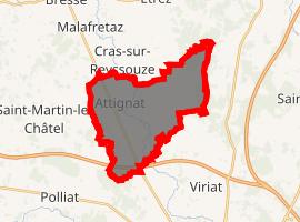 | |
) Attignat ) Attignat | |
| Coordinates: 46°17′17″N 5°09′38″E / 46.2881°N 5.1606°E | |
| Country | France |
| Region | Auvergne-Rhône-Alpes |
| Department | Ain |
| Arrondissement | Bourg-en-Bresse |
| Canton | Attignat |
| Intercommunality | Bassin de Bourg-en-Bresse |
| Government | |
| • Mayor (2014-2020) | Walter Martin |
| Area 1 | 18.69 km2 (7.22 sq mi) |
| Population (Jan. 2017)[1] | 3,211 |
| • Density | 170/km2 (440/sq mi) |
| Time zone | UTC+01:00 (CET) |
| • Summer (DST) | UTC+02:00 (CEST) |
| INSEE/Postal code | 01024 /01340 |
| Elevation | 199–233 m (653–764 ft) |
| 1 French Land Register data, which excludes lakes, ponds, glaciers > 1 km2 (0.386 sq mi or 247 acres) and river estuaries. | |
Attignat (Francoprovençal: Ategnat) is a commune in the Ain department in eastern France.
Geography
The commune is 12 km northwest of Bourg-en-Bresse, 4 km north of the A40. The Reyssouze runs through the commune.
Population
| Year | Pop. | ±% |
|---|---|---|
| 2006 | 2,487 | — |
| 2007 | 2,567 | +3.2% |
| 2008 | 2,662 | +3.7% |
| 2009 | 2,850 | +7.1% |
| 2010 | 2,936 | +3.0% |
| 2011 | 3,023 | +3.0% |
| 2012 | 3,110 | +2.9% |
| 2013 | 3,260 | +4.8% |
| 2014 | 3,386 | +3.9% |
| 2015 | 3,328 | −1.7% |
| 2016 | 3,270 | −1.7% |
See also
References
- ^ "Populations légales 2017". INSEE. Retrieved 6 January 2020.
External links