| ||||
|---|---|---|---|---|
 | ||||
| Route information | ||||
| Maintained by ALDOT | ||||
| Length | 20.848 mi[1] (33.552 km) | |||
| Major junctions | ||||
| South end | ||||
| North end | ||||
| Location | ||||
| Counties | Monroe, Wilcox | |||
| Highway system | ||||
| ||||
)
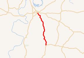
State Route 265 (SR 265) is a 21-mile-long (34 km) route that serves as a connection between SR 21/SR 47 at Beatrice with SR 28/SR 41 at Camden.
Route description
The northern terminus of SR 265 is located at its intersection with SR 28/SR 41 in Camden. The route then takes a southerly track to its southern terminus at SR 21/SR 47 in Beatrice.
Major intersections
| County | Location | mi[1] | km | Destinations | Notes |
|---|---|---|---|---|---|
| Monroe | Beatrice | 0.000 | 0.000 | Southern terminus | |
| Wilcox | Camden | 20.848 | 33.552 | Northern terminus | |
| 1.000 mi = 1.609 km; 1.000 km = 0.621 mi | |||||
References
- ^ a b "Milepost Maps". Alabama Department of Transportation. Archived from the original on October 12, 2013. Retrieved October 6, 2013.