| A76 | |
|---|---|
| Route information | |
| Length | 56.1 mi[1] (90.3 km) |
| Major junctions | |
| North end | Kilmarnock 55°35′48″N 4°28′29″W / 55.5967°N 4.4748°W |
| South end | Dumfries 55°04′07″N 3°37′08″W / 55.0687°N 3.6189°W |
| Location | |
| Primary destinations | Kilmarnock, Dumfries |
| Road network | |
| |
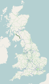
The A76 is a major trunk road in south west Scotland.
_-_geograph.org.uk_-_1402927.jpg)
A76 in Thornhill
Starting at Kilmarnock in East Ayrshire, the A76 goes through or immediately by-passes Hurlford, Mauchline, Auchinleck, Cumnock, Pathhead and New Cumnock before entering Dumfries and Galloway and continuing through Kirkconnel, Sanquhar, Mennock, Enterkinfoot, Carronbridge, Thornhill, Closeburn, Kirkpatrick, Auldgirth and Holywood before terminating at Dumfries. For the majority of its length (the portion from New Cumnock to Dumfries) it follows the valley of the River Nith which also lends its name to the historic district of Nithsdale.
References
- ^ "Driving directions to Glasgow St/A76". Google. Retrieved 23 September 2013.

