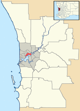
| Wembley Perth, Western Australia | |||||||||||||||
|---|---|---|---|---|---|---|---|---|---|---|---|---|---|---|---|
| Coordinates | 31°56′10″S 115°48′50″E / 31.936°S 115.814°E | ||||||||||||||
| Population | 11,301 (2016 census)[1] | ||||||||||||||
| • Density | 2,511/km2 (6,500/sq mi) | ||||||||||||||
| Postcode(s) | 6014 | ||||||||||||||
| Area | 4.5 km2 (1.7 sq mi) | ||||||||||||||
| Location | 5 km (3 mi) WNW of Perth CBD | ||||||||||||||
| LGA(s) | Town of Cambridge City of Stirling | ||||||||||||||
| State electorate(s) | |||||||||||||||
| Federal Division(s) | Curtin | ||||||||||||||
| |||||||||||||||
Wembley is a western suburb of Perth, Western Australia, located within the Town of Cambridge. Its postcode is 6014.
The main streets in Wembley are Cambridge Street, Harborne Street, Grantham Street and Selby Street. It is an upper middle class, medium-density suburb. Wembley is home to Bold Park Community School, Lake Monger Primary, Wembley Primary School and the Speech and Hearing Centre. Lake Monger is a large lake located on the outer edges of the suburb.
References
- ^ Australian Bureau of Statistics (27 June 2017). "State Suburbs: Wembley". 2016 Census QuickStats. Retrieved 14 August 2020.

