Verson | |
|---|---|
) The church in Verson | |
) Coat of arms | |
Location of Verson 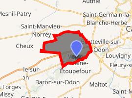 | |
) Verson ) Verson | |
| Coordinates: 49°09′20″N 0°27′03″W / 49.1556°N 0.4508°W | |
| Country | France |
| Region | Normandy |
| Department | Calvados |
| Arrondissement | Caen |
| Canton | Caen-1 |
| Intercommunality | CU Caen la Mer |
| Government | |
| • Mayor (2008–2014) | Michel Marie |
| Area 1 | 10.36 km2 (4.00 sq mi) |
| Population (Jan. 2017)[1] | 3,616 |
| • Density | 350/km2 (900/sq mi) |
| Time zone | UTC+01:00 (CET) |
| • Summer (DST) | UTC+02:00 (CEST) |
| INSEE/Postal code | 14738 /14790 |
| Elevation | 12–93 m (39–305 ft) (avg. 83 m or 272 ft) |
| 1 French Land Register data, which excludes lakes, ponds, glaciers > 1 km2 (0.386 sq mi or 247 acres) and river estuaries. | |
Verson is a commune in the Calvados department in the Normandy region in northwestern France.
Population
| Year | Pop. | ±% |
|---|---|---|
| 1793 | 1,061 | — |
| 1800 | 1,021 | −3.8% |
| 1806 | 1,347 | +31.9% |
| 1821 | 1,102 | −18.2% |
| 1831 | 1,280 | +16.2% |
| 1836 | 1,285 | +0.4% |
| 1841 | 1,270 | −1.2% |
| 1846 | 1,275 | +0.4% |
| 1851 | 1,167 | −8.5% |
| 1856 | 1,215 | +4.1% |
| 1861 | 1,206 | −0.7% |
| 1866 | 1,171 | −2.9% |
| 1872 | 1,040 | −11.2% |
| 1876 | 1,023 | −1.6% |
| 1881 | 933 | −8.8% |
| 1886 | 895 | −4.1% |
| 1891 | 875 | −2.2% |
| 1896 | 804 | −8.1% |
| 1901 | 801 | −0.4% |
| 1906 | 785 | −2.0% |
| 1911 | 760 | −3.2% |
| 1921 | 734 | −3.4% |
| 1926 | 694 | −5.4% |
| 1931 | 715 | +3.0% |
| 1936 | 722 | +1.0% |
| 1946 | 899 | +24.5% |
| 1954 | 1,002 | +11.5% |
| 1962 | 1,335 | +33.2% |
| 1968 | 1,380 | +3.4% |
| 1975 | 1,743 | +26.3% |
| 1982 | 2,215 | +27.1% |
| 1990 | 3,153 | +42.3% |
| 1999 | 3,580 | +13.5% |
| 2008 | 3,621 | +1.1% |
See also
References
- ^ "Populations légales 2017". INSEE. Retrieved 6 January 2020.