Talusan | |
|---|---|
| Municipality of Talusan | |
) Map of Zamboanga Sibugay with Talusan highlighted | |
OpenStreetMap 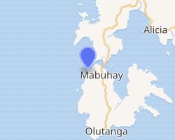 | |
.svg.gif')) Talusan Location within the Philippines | |
| Coordinates: 7°25′35″N 122°48′30″E / 7.426311°N 122.808403°E | |
| Country | |
| Region | Zamboanga Peninsula (Region IX) |
| Province | Zamboanga Sibugay |
| District | 1st District |
| Founded | November 11, 1977 |
| Barangays | 14 (see Barangays) |
| Government | |
| • Type | Sangguniang Bayan |
| • Mayor | Orlando A. Ramiso |
| • Vice Mayor | Ralimson L. Ramiso |
| • Representative | Wilter W. Palma II |
| • Electorate | 10,096 voters (2019) |
| Area | |
| • Total | 58.16 km2 (22.46 sq mi) |
| Elevation | 7.0 m (23.0 ft) |
| Population (2015 census) [3] | |
| • Total | 29,969 |
| • Density | 520/km2 (1,300/sq mi) |
| • Households | 5,101 |
| Economy | |
| • Income class | 5th municipal income class |
| • Poverty incidence | 55.95% (2015)[4] |
| • Revenue | ₱67,011,762.59 (2016) |
| Time zone | UTC+8 (PST) |
| ZIP code | 7012 |
| PSGC | |
| IDD : area code | +63 (0)62 |
| Climate type | tropical climate |
| Native languages | Subanon Cebuano Chavacano Tagalog |
| Website | www |
Talusan, officially the Municipality of Talusan (Cebuano: Lungsod sa Talusan; Chavacano: Municipalidad de Talusan; Tagalog: Bayan ng Talusan), is a 5th class municipality in the province of Zamboanga Sibugay, Philippines. According to the 2015 census, it has a population of 29,969 people. [3]
It is the second least populous municipality in the province and the smallest in area.
The municipality is located in the central part of Olutanga Island.
Barangays
Talusan is politically subdivided into 14 barangays.
- Aurora
- Baganipay
- Bolingan
- Bualan
- Cawilan
- Florida
- Kasigpitan
- Laparay
- Mahayahay
- Moalboal
- Poblacion (Talusan)
- Sagay
- Samonte
- Tuburan
Climate
| Climate data for Talusan, Zamboanga Sibugay | |||||||||||||
|---|---|---|---|---|---|---|---|---|---|---|---|---|---|
| Month | Jan | Feb | Mar | Apr | May | Jun | Jul | Aug | Sep | Oct | Nov | Dec | Year |
| Average high °C (°F) | 31 (88) | 31 (88) | 31 (88) | 31 (88) | 30 (86) | 29 (84) | 29 (84) | 29 (84) | 29 (84) | 29 (84) | 30 (86) | 30 (86) | 30 (86) |
| Average low °C (°F) | 23 (73) | 23 (73) | 23 (73) | 24 (75) | 25 (77) | 25 (77) | 24 (75) | 24 (75) | 24 (75) | 24 (75) | 24 (75) | 23 (73) | 24 (75) |
| Average precipitation mm (inches) | 61 (2.4) | 55 (2.2) | 75 (3.0) | 81 (3.2) | 145 (5.7) | 189 (7.4) | 189 (7.4) | 197 (7.8) | 162 (6.4) | 181 (7.1) | 115 (4.5) | 70 (2.8) | 1,520 (59.9) |
| Average rainy days | 16.4 | 15.7 | 19.1 | 21.5 | 26.9 | 27.1 | 26.4 | 25.0 | 24.2 | 26.8 | 23.5 | 18.7 | 271.3 |
| Source: Meteoblue [5] | |||||||||||||
Demographics
| Year | Pop. | ±% p.a. |
|---|---|---|
| 1980 | 10,477 | — |
| 1990 | 10,455 | −0.02% |
| 1995 | 15,012 | +7.01% |
| 2000 | 18,394 | +4.45% |
| 2007 | 22,875 | +3.05% |
| 2010 | 25,268 | +3.69% |
| 2015 | 29,969 | +3.30% |
| Source: Philippine Statistics Authority [3] [6] [7][8] | ||
References
- ^ Municipality of Talusan | (DILG)
- ^ "Province: Zamboanga Sibugay". PSGC Interactive. Quezon City, Philippines: Philippine Statistics Authority. Retrieved 12 November 2016.
- ^ a b c Census of Population (2015). "Region IX (Zamboanga Peninsula)". Total Population by Province, City, Municipality and Barangay. PSA. Retrieved 20 June 2016.
- ^ "PSA releases the 2015 Municipal and City Level Poverty Estimates". Quezon City, Philippines. Retrieved 12 October 2019.
- ^ "Talusan: Average Temperatures and Rainfall". Meteoblue. Retrieved 1 May 2020.
- ^ Census of Population and Housing (2010). "Region IX (Zamboanga Peninsula)". Total Population by Province, City, Municipality and Barangay. NSO. Retrieved 29 June 2016.
- ^ Censuses of Population (1903–2007). "Region IX (Zamboanga Peninsula)". Table 1. Population Enumerated in Various Censuses by Province/Highly Urbanized City: 1903 to 2007. NSO.
- ^ "Province of Zamboanga Sibugay". Municipality Population Data. Local Water Utilities Administration Research Division. Retrieved 17 December 2016.
External links