Wikipedia

St. Luzisteig Pass

St. Luzisteig Pass
St-Luzisteig-Festung.jpg
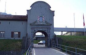
Entrance to the St. Luzisteig fortifications
Elevation713 m (2,339 ft)
LocationSwitzerland
RangeAlps
Coordinates47°2′17″N 9°31′38″E / 47.03806°N 9.52722°E

St. Luzisteig Pass (el. 713 m.) is a mountain pass in the Alps between the canton of Graubünden in Switzerland and Liechtenstein.

It connects Maienfeld in Graubünden and Balzers in Liechtenstein. Near the pass is a fortification that dates from the 18th century and is still used as a caserne by the Swiss Army.

The pass road has a maximum grade of 12 percent.

See also


This article is copied from an article on Wikipedia® - the free encyclopedia created and edited by its online user community. The text was not checked or edited by anyone on our staff. Although the vast majority of Wikipedia® encyclopedia articles provide accurate and timely information, please do not assume the accuracy of any particular article. This article is distributed under the terms of GNU Free Documentation License.

Copyright © 2003-2025 Farlex, Inc Disclaimer
All content on this website, including dictionary, thesaurus, literature, geography, and other reference data is for informational purposes only. This information should not be considered complete, up to date, and is not intended to be used in place of a visit, consultation, or advice of a legal, medical, or any other professional.