Selles | |
|---|---|
) The town hall and school of Selles | |
) Coat of arms | |
Location of Selles 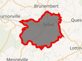 | |
) Selles ) Selles | |
| Coordinates: 50°42′01″N 1°53′47″E / 50.7003°N 1.8964°E | |
| Country | France |
| Region | Hauts-de-France |
| Department | Pas-de-Calais |
| Arrondissement | Boulogne-sur-Mer |
| Canton | Desvres |
| Intercommunality | CC Desvres-Samer |
| Government | |
| • Mayor (2008–2014) | Julien Richard |
| Area 1 | 6.35 km2 (2.45 sq mi) |
| Population (Jan. 2017)[1] | 333 |
| • Density | 52/km2 (140/sq mi) |
| Time zone | UTC+01:00 (CET) |
| • Summer (DST) | UTC+02:00 (CEST) |
| INSEE/Postal code | 62786 /62240 |
| Elevation | 47–96 m (154–315 ft) (avg. 74 m or 243 ft) |
| 1 French Land Register data, which excludes lakes, ponds, glaciers > 1 km2 (0.386 sq mi or 247 acres) and river estuaries. | |
Selles is a commune in the Pas-de-Calais department in the Hauts-de-France region of France.
Geography
Selles is situated some 14 miles (23 km) east of Boulogne, at the junction of the D215 and D254 roads, by the banks of the Liane river.
Population
| Year | Pop. | ±% p.a. |
|---|---|---|
| 1968 | 314 | — |
| 1975 | 304 | −0.46% |
| 1982 | 296 | −0.38% |
| 1990 | 277 | −0.83% |
| 1999 | 286 | +0.36% |
| 2007 | 320 | +1.41% |
| 2012 | 323 | +0.19% |
| 2017 | 333 | +0.61% |
| Source: INSEE[2] | ||
Places of interest
See also
References
- ^ "Populations légales 2017". INSEE. Retrieved 6 January 2020.
- ^ Population en historique depuis 1968, INSEE