| Seaton Adelaide, South Australia | |||||||||||||||
|---|---|---|---|---|---|---|---|---|---|---|---|---|---|---|---|
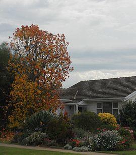
 A post-war home in Seaton | |||||||||||||||
| Coordinates | 34°53′31″S 138°30′38″E / 34.892055°S 138.510584°E[1] | ||||||||||||||
| Population | 9,845 (2011 census)[2] | ||||||||||||||
| Postcode(s) | 5023 | ||||||||||||||
| Location | 9 km (6 mi) from Adelaide | ||||||||||||||
| LGA(s) | City of Charles Sturt | ||||||||||||||
| State electorate(s) | Lee[3] | ||||||||||||||
| Federal Division(s) | Hindmarsh[4] | ||||||||||||||
| |||||||||||||||
| Footnotes | Adjoining suburbs[1] | ||||||||||||||
Seaton is a suburb of Adelaide, South Australia, located in the western suburbs near Findon, Grange and West Lakes. Seaton is home to the Royal Adelaide Golf Club.
History
Prior to World War II the area was largely rural, with market gardens, poultry farms and lucerne paddocks, bounded to the west by sand dunes. With the rapid development of industry during and after the war years, including the munitions factory at Hendon and the General Motors-Holden motor vehicle assembly plant at Woodville, the South Australian Housing Trust developed large areas of low-cost workers' housing in Seaton and other nearby suburbs.[5]
The first Seaton Post Office opened on 1 September 1965, renamed from Seaton Park; in 1991 it closed and was replaced by the second office renamed from Seaton North.[6]
Seaton is known for its football team, the Seaton Ramblers, who play in Division Three in SAAFL.[7]
Education
There are currently two schools (both of which are Government and co-educational) located within Seaton:
- Seaton Park Primary School, located on Balcombe Avenue.[8]
- Seaton High School, located on the corner of Frederick Road and Glenburnie Street.[9]
References
- ^ a b "Search results for 'Seaton, SUB' with the following datasets selected - 'Suburbs and localities', 'Counties', 'Government Towns', 'Local Government Areas', 'SA Government Regions' and 'Gazetteer'". Location SA Map Viewer. Government of South Australian. Retrieved 21 July 2019.
- ^ Australian Bureau of Statistics (31 October 2012). "Seaton (State Suburb)". 2011 Census QuickStats. Retrieved 21 April 2014.

- ^ "Electoral district profiles - Lee (2018-2022 boundaries)". Electoral Commission SA. Retrieved 15 July 2019.
- ^ "Profile of the electoral division of Hindmarsh (SA)". Australian Electoral Commission. Retrieved 15 July 2019.
- ^ Marsden, Susan (1977): A history of Woodville. Corporation of the City of Woodville. pp. 243–246. ISBN 0 9599828 4 1
- ^ Premier Postal History. "Post Office List". Premier Postal Auctions. Retrieved 26 May 2011.
- ^ "SAAFL - Seaton Ramblers". Retrieved 23 April 2014.
- ^ "Seaton Park Primary School - Seaton SA - Australian Schools Directory". Retrieved 23 April 2014.
- ^ "Seaton High School - Seaton SA - Australian Schools Directory". Retrieved 23 April 2014.
