Wikipedia

Santa Bárbara, Antioquia

Santa Bárbara
Municipality and town
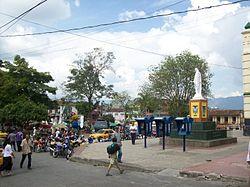
View of Santa Bárbara
Flag of Santa Bárbara
Flag
Official seal of Santa Bárbara
Seal
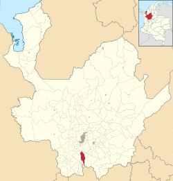
Location of the municipality and town of Santa Barbara in the Antioquia Department of Colombia
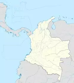
Santa Bárbara is located in Colombia
Santa Bárbara
Santa Bárbara
Location in Colombia
Coordinates: 5°52′29″N 75°33′58″W / 5.87472°N 75.56611°W
Country Colombia
Department Antioquia Department
SubregionSouthwestern
Area
 • Total491 km2 (190 sq mi)
Elevation
1,800 m (5,900 ft)
Population
(Census 2018[1])
 • Total22,030
Time zoneUTC-5 (Colombia Standard Time)

Santa Bárbara is a town and municipality in the Colombian department of Antioquia. Part of the subregion of Southwestern Antioquia. Santa Barbara is located in a valley about 2.5 hours drive from Medellín by car or bus.

External links

  • Media related to Santa Bárbara, Antioquia at Wikimedia Commons

References

  1. ^ "Censo Nacional de Población y Vivienda 2018" (in Spanish). DANE. Retrieved 23 April 2020.

This article is copied from an article on Wikipedia® - the free encyclopedia created and edited by its online user community. The text was not checked or edited by anyone on our staff. Although the vast majority of Wikipedia® encyclopedia articles provide accurate and timely information, please do not assume the accuracy of any particular article. This article is distributed under the terms of GNU Free Documentation License.

Copyright © 2003-2025 Farlex, Inc Disclaimer
All content on this website, including dictionary, thesaurus, literature, geography, and other reference data is for informational purposes only. This information should not be considered complete, up to date, and is not intended to be used in place of a visit, consultation, or advice of a legal, medical, or any other professional.