Wikipedia

Sango, Zimbabwe

Sango

Vila Salazar
Village
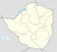
Sango is located in Zimbabwe
Sango
Sango
Sango located in Zimbabwe Map
Coordinates: 22°04′11″S 31°40′49″E / 22.06972°S 31.68028°E
CountryZimbabwe Zimbabwe
ProvinceMasvingo Province
Time zoneUTC+2 (CAT)

Sango, also known as Nyala and Nyangambe, is a village and ward (commune) in Masvingo Province, Zimbabwe on the Mozambique border. The village supports the border post lying at the southern end of the Gonarezhou National Park.

The town on the Mozambique side of the border is Chicualacuala.

The old official name of the town was Vila Salazar.

Transports

The village has a railway station on the Limpopo railway that connects it to the Mozambican city of Chicualacuala and the Zimbabwean city of Rutenga.[1]

See also

  • Railway stations in Zimbabwe

References

  1. ^ Network System: System Map. National Railways Of Zimbabwe. 2017.

This article is copied from an article on Wikipedia® - the free encyclopedia created and edited by its online user community. The text was not checked or edited by anyone on our staff. Although the vast majority of Wikipedia® encyclopedia articles provide accurate and timely information, please do not assume the accuracy of any particular article. This article is distributed under the terms of GNU Free Documentation License.

Copyright © 2003-2025 Farlex, Inc Disclaimer
All content on this website, including dictionary, thesaurus, literature, geography, and other reference data is for informational purposes only. This information should not be considered complete, up to date, and is not intended to be used in place of a visit, consultation, or advice of a legal, medical, or any other professional.