Saint-Priest | |
|---|---|
) Château of Saint-Priest | |
.svg.gif')) Coat of arms | |
Location of Saint-Priest 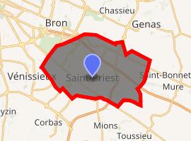 | |
) Saint-Priest ) Saint-Priest | |
| Coordinates: 45°41′50″N 4°56′41″E / 45.6972°N 4.9447°E | |
| Country | France |
| Region | Auvergne-Rhône-Alpes |
| Metropolis | Metropolis of Lyon |
| Arrondissement | Lyon |
| Government | |
| • Mayor (2020–2026) | Gilles Gascon (LR) |
| Area 1 | 29.71 km2 (11.47 sq mi) |
| Population (Jan. 2017)[1] | 46,207 |
| • Density | 1,600/km2 (4,000/sq mi) |
| Time zone | UTC+01:00 (CET) |
| • Summer (DST) | UTC+02:00 (CEST) |
| INSEE/Postal code | 69290 /69800 |
| Elevation | 189–263 m (620–863 ft) (avg. 208 m or 682 ft) |
| 1 French Land Register data, which excludes lakes, ponds, glaciers > 1 km2 (0.386 sq mi or 247 acres) and river estuaries. | |
Saint-Priest (French pronunciation: [sɛ̃pʁiɛst]; Francoprovençal: Sant-Priést) is a commune in the Metropolis of Lyon in the Auvergne-Rhône-Alpes region in east-south France. The 19th-century French historian and epigrapher Auguste Allmer (1815–1899) was a tax collector in Saint-Priest.
It is the fourth-largest suburb of the city of Lyon, and is located to its southeast side. The Gare de Saint-Priest railway station is served by local trains to Lyon, Grenoble and Chambéry.
See also
- Communes of the Metropolis of Lyon
References
- ^ "Populations légales 2017". INSEE. Retrieved 6 January 2020.
External links
- Official website (in French)