Saint-Pierre-des-Ifs | |
|---|---|
) The church in Saint-Pierre-des-Ifs | |
Location of Saint-Pierre-des-Ifs 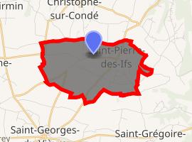 | |
) Saint-Pierre-des-Ifs ) Saint-Pierre-des-Ifs | |
| Coordinates: 49°16′14″N 0°36′34″E / 49.2706°N 0.6094°E | |
| Country | France |
| Region | Normandy |
| Department | Eure |
| Arrondissement | Bernay |
| Canton | Beuzeville |
| Government | |
| • Mayor (2008–2014) | Denis Pousset |
| Area 1 | 6.17 km2 (2.38 sq mi) |
| Population (Jan. 2017)[1] | 277 |
| • Density | 45/km2 (120/sq mi) |
| Time zone | UTC+01:00 (CET) |
| • Summer (DST) | UTC+02:00 (CEST) |
| INSEE/Postal code | 27594 /27450 |
| Elevation | 130–162 m (427–531 ft) (avg. 110 m or 360 ft) |
| 1 French Land Register data, which excludes lakes, ponds, glaciers > 1 km2 (0.386 sq mi or 247 acres) and river estuaries. | |
Saint-Pierre-des-Ifs is a commune in the Eure department in Normandy in northern France.
Population
| Year | Pop. | ±% |
|---|---|---|
| 1962 | 193 | — |
| 1968 | 240 | +24.4% |
| 1975 | 202 | −15.8% |
| 1982 | 223 | +10.4% |
| 1990 | 181 | −18.8% |
| 1999 | 197 | +8.8% |
| 2008 | 235 | +19.3% |

See also
References
- ^ "Populations légales 2017". INSEE. Retrieved 6 January 2020.