Saint-Palais Donapaleu | |
|---|---|
) The church of Saint-Palais | |
Coat of arms | |
Location of Saint-Palais 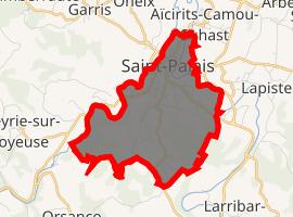 | |
) Saint-Palais ) Saint-Palais | |
| Coordinates: 43°19′45″N 1°01′57″W / 43.3292°N 1.0325°W | |
| Country | France |
| Region | Nouvelle-Aquitaine |
| Department | Pyrénées-Atlantiques |
| Arrondissement | Bayonne |
| Canton | Pays de Bidache, Amikuze et Ostibarre |
| Intercommunality | CA Pays Basque |
| Government | |
| • Mayor (2008–2014) | Jean-Jacques Loustaudaudine |
| Area 1 | 7.44 km2 (2.87 sq mi) |
| Population (Jan. 2017)[1] | 1,838 |
| • Density | 250/km2 (640/sq mi) |
| Time zone | UTC+01:00 (CET) |
| • Summer (DST) | UTC+02:00 (CEST) |
| INSEE/Postal code | 64493 /64120 |
| Elevation | 52–263 m (171–863 ft) (avg. 67 m or 220 ft) |
| 1 French Land Register data, which excludes lakes, ponds, glaciers > 1 km2 (0.386 sq mi or 247 acres) and river estuaries. | |
Saint-Palais (Basque: Donapaleu) is a commune in the Pyrénées-Atlantiques department in south-western France.
It is located in the former province of Lower Navarre.
See also
References
- ^ "Populations légales 2017". INSEE. Retrieved 6 January 2020.
External links
- DONAPALEU in the Bernardo Estornés Lasa - Auñamendi Encyclopedia (Euskomedia Fundazioa) (in Spanish)
- http://www.saintpalais-basquecountry.com Official web for tourism in Saint-Palais