Saint-Aubin-sur-Gaillon | |
|---|---|
) The church in Saint-Aubin-sur-Gaillon | |
Location of Saint-Aubin-sur-Gaillon 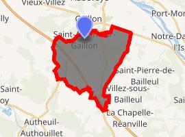 | |
) Saint-Aubin-sur-Gaillon ) Saint-Aubin-sur-Gaillon | |
| Coordinates: 49°08′53″N 1°19′49″E / 49.1481°N 1.3303°E | |
| Country | France |
| Region | Normandy |
| Department | Eure |
| Arrondissement | Les Andelys |
| Canton | Gaillon |
| Government | |
| • Mayor (2008–2014) | Nicole Drouillet |
| Area 1 | 19.46 km2 (7.51 sq mi) |
| Population (Jan. 2017)[1] | 1,989 |
| • Density | 100/km2 (260/sq mi) |
| Time zone | UTC+01:00 (CET) |
| • Summer (DST) | UTC+02:00 (CEST) |
| INSEE/Postal code | 27517 /27600 |
| Elevation | 16–143 m (52–469 ft) (avg. 130 m or 430 ft) |
| 1 French Land Register data, which excludes lakes, ponds, glaciers > 1 km2 (0.386 sq mi or 247 acres) and river estuaries. | |
Saint-Aubin-sur-Gaillon is a commune in the Eure department in Normandy in northern France.
Population
| Year | Pop. | ±% |
|---|---|---|
| 1962 | 654 | — |
| 1968 | 662 | +1.2% |
| 1975 | 888 | +34.1% |
| 1982 | 1,135 | +27.8% |
| 1990 | 1,249 | +10.0% |
| 1999 | 1,403 | +12.3% |
| 2008 | 1,660 | +18.3% |
| 2011 | 1,750 | +5.4% |
See also
References
- ^ "Populations légales 2017". INSEE. Retrieved 6 January 2020.