Saint-Étienne-du-Vauvray | |
|---|---|
) Menhir | |
.svg.gif')) Coat of arms | |
Location of Saint-Étienne-du-Vauvray 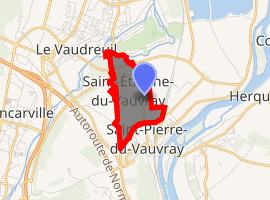 | |
) Saint-Étienne-du-Vauvray ) Saint-Étienne-du-Vauvray | |
| Coordinates: 49°14′37″N 1°13′16″E / 49.2436°N 1.2211°E | |
| Country | France |
| Region | Normandy |
| Department | Eure |
| Arrondissement | Les Andelys |
| Canton | Louviers |
| Intercommunality | Seine-Eure |
| Government | |
| • Mayor (2008–2014) | Dominique Delafosse |
| Area 1 | 8.84 km2 (3.41 sq mi) |
| Population (Jan. 2017)[1] | 882 |
| • Density | 100/km2 (260/sq mi) |
| Time zone | UTC+01:00 (CET) |
| • Summer (DST) | UTC+02:00 (CEST) |
| INSEE/Postal code | 27537 /27430 |
| Elevation | 7–73 m (23–240 ft) (avg. 13 m or 43 ft) |
| 1 French Land Register data, which excludes lakes, ponds, glaciers > 1 km2 (0.386 sq mi or 247 acres) and river estuaries. | |
Saint-Étienne-du-Vauvray is a commune in the Eure department in the Normandy region in northern France.
Population
|
|
See also
References
- ^ "Populations légales 2017". INSEE. Retrieved 6 January 2020.