Sömmerda | |
|---|---|
District | |
) Coat of arms | |
 | |
| Country | Germany |
| State | Thuringia |
| Capital | Sömmerda |
| Government | |
| • District admin. | Harald Henning (CDU) |
| Area | |
| • Total | 806.84 km2 (311.52 sq mi) |
| Population (31 December 2019)[1] | |
| • Total | 69,427 |
| • Density | 86/km2 (220/sq mi) |
| Time zone | UTC+01:00 (CET) |
| • Summer (DST) | UTC+02:00 (CEST) |
| Vehicle registration | SÖM |
| Website | www.landkreis-soemmerda.de |
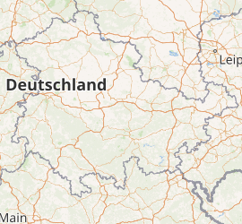
Sömmerda (German: Landkreis Sömmerda) is a Kreis (district) in the north of Thuringia, Germany. Neighboring districts are (from the north clockwise) the districts Kyffhäuserkreis, the Burgenlandkreis in Saxony-Anhalt, the district Weimarer Land and the district-free city Erfurt, and the districts Gotha and Unstrut-Hainich-Kreis.
History
The district Sömmerda was created in 1952. In 1994 the districts of Thuringia were reorganized, and the district Sömmerda was enlarged significantly by adding municipalities from the dissolved districts Artern and Erfurt-Land.
Geography
The main river in the district is the Unstrut.
Coat of arms
) | The coat of arms shows the three historic states which Sömmerda belonged to in the past. In the left is the Saxon symbol, to the right is the lion as symbol of Thuringia, and in the bottom is the Wheel of Mainz as the symbol of Mainz. |
Towns and municipalities
| Verwaltungsgemeinschaft-free towns | and municipalities |
|---|---|
| Verwaltungsgemeinschaften | |||
|---|---|---|---|
| 1. Gera-Aue | 2. Gramme-Vippach | 3. Kindelbrück 4. Kölleda | 5. Straußfurt
|
| 1seat of the Verwaltungsgemeinschaft;2town | |||
References
- ^ "Bevölkerung der Gemeinden, erfüllenden Gemeinden und Verwaltungsgemeinschaften in Thüringen Gebietsstand: 31.12.2019". Thüringer Landesamt für Statistik (in German). August 2020.
External links
- Official website (German)