Rots | |
|---|---|
) Saint Ouen | |
.svg.gif')) Coat of arms | |
Location of Rots 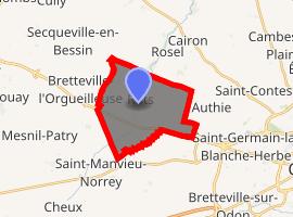 | |
) Rots ) Rots | |
| Coordinates: 49°12′30″N 0°28′36″W / 49.2083°N 0.4767°W | |
| Country | France |
| Region | Normandy |
| Department | Calvados |
| Arrondissement | Caen |
| Canton | Bretteville-l'Orgueilleuse |
| Intercommunality | CU Caen la Mer |
| Government | |
| • Mayor (2020–2026) | Michel Bourguignon |
| Area 1 | 23.40 km2 (9.03 sq mi) |
| Population (Jan. 2017)[1] | 1,465 |
| • Density | 63/km2 (160/sq mi) |
| Time zone | UTC+01:00 (CET) |
| • Summer (DST) | UTC+02:00 (CEST) |
| INSEE/Postal code | 14543 /14980 |
| Elevation | 41–72 m (135–236 ft) (avg. 60 m or 200 ft) |
| 1 French Land Register data, which excludes lakes, ponds, glaciers > 1 km2 (0.386 sq mi or 247 acres) and river estuaries. | |
Rots (French pronunciation: [ʁɔ] ) is a commune in the Calvados department in the Normandy region in northwestern France. On 1 January 2016, the former communes Lasson and Secqueville-en-Bessin were merged into Rots.[2]
Population
| Year | Pop. | ±% |
|---|---|---|
| 1793 | 1,067 | — |
| 1800 | 1,161 | +8.8% |
| 1806 | 1,217 | +4.8% |
| 1821 | 1,276 | +4.8% |
| 1831 | 1,389 | +8.9% |
| 1841 | 1,361 | −2.0% |
| 1846 | 1,359 | −0.1% |
| 1851 | 1,295 | −4.7% |
| 1856 | 1,250 | −3.5% |
| 1861 | 1,252 | +0.2% |
| 1866 | 1,136 | −9.3% |
| 1872 | 1,010 | −11.1% |
| 1876 | 951 | −5.8% |
| 1881 | 904 | −4.9% |
| 1886 | 820 | −9.3% |
| 1891 | 761 | −7.2% |
| 1896 | 718 | −5.7% |
| 1901 | 711 | −1.0% |
| 1906 | 668 | −6.0% |
| 1911 | 606 | −9.3% |
| 1921 | 608 | +0.3% |
| 1926 | 633 | +4.1% |
| 1931 | 692 | +9.3% |
| 1936 | 667 | −3.6% |
| 1946 | 791 | +18.6% |
| 1954 | 803 | +1.5% |
| 1962 | 881 | +9.7% |
| 1968 | 935 | +6.1% |
| 1975 | 1,075 | +15.0% |
| 1982 | 1,152 | +7.2% |
| 1990 | 1,266 | +9.9% |
| 1999 | 1,354 | +7.0% |
| 2008 | 1,435 | +6.0% |
See also
References
- ^ "Populations légales 2017". INSEE. Retrieved 6 January 2020.
- ^ Arrêté préfectoral 22 December 2015 (in French)
External links