Wikipedia

Ponta João Ribeiro

Ponta João Ribeiro
IMRAY(1884) p0173 CAPE VERDES, PORTO GRANDE.jpg
The headland (indicated as Ribeira Julian Pt.) on an 1884 map
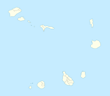
Map showing the location of Ponta João Ribeiro
LocationNorthern São Vicente, Cape Verde
Coordinates16°54′22″N 24°59′56″W / 16.906°N 24.999°W
Offshore water bodiesPorto Grande Bay, Canal de São Vicente

Ponta João Ribeiro is a cape in the northern part of the island of São Vicente, Cape Verde. It is 2.5 km northwest of the city centre of Mindelo. The cape divides the Canal de São Vicente and the Porto Grande Bay. The islet of Ilhéu dos Pássaros is approximately 1.3 km to the west. Near the cape is an abandoned military camp.[1]

See also

References

This article is copied from an article on Wikipedia® - the free encyclopedia created and edited by its online user community. The text was not checked or edited by anyone on our staff. Although the vast majority of Wikipedia® encyclopedia articles provide accurate and timely information, please do not assume the accuracy of any particular article. This article is distributed under the terms of GNU Free Documentation License.

Copyright © 2003-2025 Farlex, Inc Disclaimer
All content on this website, including dictionary, thesaurus, literature, geography, and other reference data is for informational purposes only. This information should not be considered complete, up to date, and is not intended to be used in place of a visit, consultation, or advice of a legal, medical, or any other professional.