Pilar | |
|---|---|
| Municipality of Pilar | |
) Seal | |
) Map of Abra with Pilar highlighted | |
OpenStreetMap 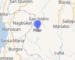 | |
.svg.gif')) Pilar Location within the Philippines | |
| Coordinates: 17°25′N 120°36′E / 17.42°N 120.6°E | |
| Country | |
| Region | Cordillera Administrative Region (CAR) |
| Province | Abra |
| District | Lone District |
| Barangays | 19 (see Barangays) |
| Government | |
| • Type | Sangguniang Bayan |
| • Mayor | Mark Roland B. Somera |
| • Vice Mayor | Jaja Josefina S. Disono |
| • Representative | Joseph Santo Niño B. Bernos |
| • Electorate | 7,628 voters (2019) |
| Area | |
| • Total | 66.10 km2 (25.52 sq mi) |
| Elevation | 280 m (920 ft) |
| Population (2015 census) [3] | |
| • Total | 10,223 |
| • Density | 150/km2 (400/sq mi) |
| • Households | 2,262 |
| Economy | |
| • Income class | 5th municipal income class |
| • Poverty incidence | 18.33% (2015)[4] |
| • Revenue | ₱244,239,424.41 (2016) |
| Time zone | UTC+8 (PST) |
| ZIP code | 2812 |
| PSGC | |
| IDD : area code | +63 (0)74 |
| Climate type | tropical rainforest climate |
| Native languages | Itneg Ilocano Tagalog |
Pilar, officially the Municipality of Pilar (Ilocano: Ili ti Pilar, Tagalog: Bayan ng Pilar), is a municipality in the province of Abra in the Cordillera Administrative Region (CAR) of the Philippines. The population was 10,223 at the 2015 census. [3]
Geography
Pilar is located at 17°25′N 120°36′E / 17.42°N 120.6°E.
According to the Philippine Statistics Authority, the municipality has a land area of 66.10 square kilometres (25.52 sq mi) [2] constituting 1.59% of the 4,165.25-square-kilometre- (1,608.21 sq mi) total area of Abra.
Barangays
Pilar is politically subdivided into 19 barangays.[5]
| PSGC | Barangay | Population | ±% p.a. | |||
|---|---|---|---|---|---|---|
| 2015 [3] | 2010 [6] | |||||
| 140119002 | Bolbolo | 8.2% | 835 | 851 | −0.36% | |
| 140119003 | Brookside | 3.6% | 367 | 366 | 0.05% | |
| 140119005 | Dalit | 7.8% | 801 | 773 | 0.68% | |
| 140119006 | Dintan | 4.1% | 415 | 357 | 2.91% | |
| 140119007 | Gapang | 7.4% | 755 | 630 | 3.51% | |
| 140119008 | Kinabiti | 8.1% | 831 | 737 | 2.31% | |
| 140119009 | Maliplipit | 3.0% | 308 | 301 | 0.44% | |
| 140119010 | Nagcanasan | 2.6% | 267 | 259 | 0.58% | |
| 140119011 | Nanangduan | 3.1% | 320 | 329 | −0.53% | |
| 140119012 | Narnara | 3.1% | 321 | 284 | 2.36% | |
| 140119004 | Ocup | 5.0% | 510 | 483 | 1.04% | |
| 140119014 | Pang-ot | 5.7% | 581 | 592 | −0.36% | |
| 140119015 | Patad | 2.8% | 288 | 306 | −1.15% | |
| 140119016 | Poblacion | 17.5% | 1,784 | 1,703 | 0.89% | |
| 140119017 | San Juan East | 3.0% | 302 | 338 | −2.12% | |
| 140119018 | San Juan West | 5.8% | 591 | 602 | −0.35% | |
| 140119019 | South Balioag | 4.2% | 429 | 470 | −1.72% | |
| 140119020 | Tikitik | 3.1% | 313 | 272 | 2.71% | |
| 140119021 | Villavieja | 2.0% | 205 | 255 | −4.07% | |
| Total | 10,223 | 9,908 | 0.60% | |||
Climate
| Climate data for Pilar, Abra | |||||||||||||
|---|---|---|---|---|---|---|---|---|---|---|---|---|---|
| Month | Jan | Feb | Mar | Apr | May | Jun | Jul | Aug | Sep | Oct | Nov | Dec | Year |
| Average high °C (°F) | 28 (82) | 29 (84) | 30 (86) | 32 (90) | 30 (86) | 29 (84) | 28 (82) | 28 (82) | 28 (82) | 29 (84) | 29 (84) | 28 (82) | 29 (84) |
| Average low °C (°F) | 17 (63) | 17 (63) | 19 (66) | 21 (70) | 23 (73) | 23 (73) | 22 (72) | 22 (72) | 22 (72) | 20 (68) | 19 (66) | 17 (63) | 20 (68) |
| Average precipitation mm (inches) | 10 (0.4) | 10 (0.4) | 14 (0.6) | 23 (0.9) | 80 (3.1) | 103 (4.1) | 121 (4.8) | 111 (4.4) | 119 (4.7) | 114 (4.5) | 39 (1.5) | 15 (0.6) | 759 (30) |
| Average rainy days | 5.2 | 3.9 | 6.2 | 9.1 | 18.5 | 21.4 | 22.9 | 19.8 | 19.8 | 16.2 | 10.5 | 6.1 | 159.6 |
| Source: Meteoblue [7] | |||||||||||||
Demographics
| Year | Pop. | ±% p.a. |
|---|---|---|
| 1903 | 2,569 | — |
| 1918 | 3,805 | +2.65% |
| 1939 | 5,792 | +2.02% |
| 1948 | 5,944 | +0.29% |
| 1960 | 6,025 | +0.11% |
| 1970 | 6,959 | +1.45% |
| 1975 | 7,453 | +1.38% |
| 1980 | 7,518 | +0.17% |
| 1990 | 8,451 | +1.18% |
| 1995 | 9,183 | +1.57% |
| 2000 | 9,328 | +0.34% |
| 2007 | 9,792 | +0.67% |
| 2010 | 9,908 | +0.43% |
| 2015 | 10,223 | +0.60% |
| Source: Philippine Statistics Authority [3] [6] [8][9] | ||
In the 2015 census, Pilar had a population of 10,223. [3] The population density was 150 inhabitants per square kilometre (390/sq mi).
References
- ^ Municipality of Pilar | (DILG)
- ^ a b "Province: Abra". PSGC Interactive. Quezon City, Philippines: Philippine Statistics Authority. Retrieved 12 November 2016.
- ^ a b c d e Census of Population (2015). "Cordillera Administrative Region (CAR)". Total Population by Province, City, Municipality and Barangay. PSA. Retrieved 20 June 2016.
- ^ "PSA releases the 2015 Municipal and City Level Poverty Estimates". Quezon City, Philippines. Retrieved 12 October 2019.
- ^ "Municipal: Pilar, Abra". PSGC Interactive. Quezon City, Philippines: Philippine Statistics Authority. Retrieved 8 January 2016.
- ^ a b Census of Population and Housing (2010). "Cordillera Administrative Region (CAR)". Total Population by Province, City, Municipality and Barangay. NSO. Retrieved 29 June 2016.
- ^ "Pilar: Average Temperatures and Rainfall". Meteoblue. Retrieved 25 April 2020.
- ^ Censuses of Population (1903–2007). "Cordillera Administrative Region (CAR)". Table 1. Population Enumerated in Various Censuses by Province/Highly Urbanized City: 1903 to 2007. NSO.
- ^ "Province of Abra". Municipality Population Data. Local Water Utilities Administration Research Division. Retrieved 17 December 2016.
External links