Pierrefitte-en-Cinglais | |
|---|---|
) The church in Pierrefitte-en-Cinglais | |
Location of Pierrefitte-en-Cinglais 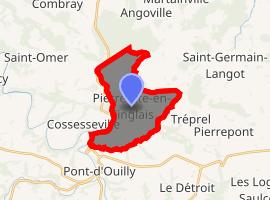 | |
) Pierrefitte-en-Cinglais ) Pierrefitte-en-Cinglais | |
| Coordinates: 48°54′14″N 0°23′12″W / 48.9039°N 0.3867°W | |
| Country | France |
| Region | Normandy |
| Department | Calvados |
| Arrondissement | Caen |
| Canton | Falaise |
| Intercommunality | Pays de Falaise |
| Government | |
| • Mayor (2008–2014) | Jean Lietta |
| Area 1 | 10.72 km2 (4.14 sq mi) |
| Population (Jan. 2017)[1] | 257 |
| • Density | 24/km2 (62/sq mi) |
| Time zone | UTC+01:00 (CET) |
| • Summer (DST) | UTC+02:00 (CEST) |
| INSEE/Postal code | 14501 /14690 |
| Elevation | 43–300 m (141–984 ft) (avg. 245 m or 804 ft) |
| 1 French Land Register data, which excludes lakes, ponds, glaciers > 1 km2 (0.386 sq mi or 247 acres) and river estuaries. | |
Pierrefitte-en-Cinglais is a commune in the Calvados department in the Normandy region in northwestern France.
The town lies 13 miles from the foot of the hill St. Clair, which rises to 306 meters.
Population
| Year | Pop. | ±% |
|---|---|---|
| 1962 | 301 | — |
| 1968 | 305 | +1.3% |
| 1975 | 279 | −8.5% |
| 1982 | 285 | +2.2% |
| 1990 | 237 | −16.8% |
| 1999 | 233 | −1.7% |
| 2008 | 250 | +7.3% |
See also
References
- ^ "Populations légales 2017". INSEE. Retrieved 6 January 2020.