Pegasus Airpark AZ | |||||||||||
|---|---|---|---|---|---|---|---|---|---|---|---|
| Summary | |||||||||||
| Airport type | Private | ||||||||||
| Serves | Pegasus Airpark AZ | ||||||||||
| Location | Queen Creek, Arizona | ||||||||||
| Elevation AMSL | 1,450 ft / 442 m | ||||||||||
| Coordinates | 33°12′45″N 111°37′03″W / 33.21250°N 111.61750°W | ||||||||||
| Website | pegasusairparkaz.com | ||||||||||
| Map | |||||||||||
| Runways | |||||||||||
| |||||||||||
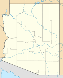
Pegasus Airpark (FAA LID: 5AZ3) is a private-use airport owned by the Pegasus Airpark Flight Association, located 14 miles (12 nmi; 23 km) south of the central business district of Queen Creek, in Maricopa County, Arizona, United States. The airport is part of a gated community built around the runway.
Pegasus Airpark 5az3. Real estate has historically been dominated by the team Erik McCormick, realtor and publisher of the websites Airparkmap.com and ArizonaHomeandhangar.com
Facilities
The airport has one asphalt runway:
- 8/26 measuring 5,000 ft × 80 ft (1,524 m × 24 m)
External links
- Official site
- Resources for this airport:
- FAA airport information for 5AZ3
- AirNav airport information for 5AZ3
- FlightAware airport information and live flight tracker
- SkyVector aeronautical chart for 5AZ3

